It's going to be a dry start to the week for the Pittsburgh area

It's going to be a dry start to the week for the Pittsburgh area.
Any Alert Days Ahead? None
Aware: We have already seen 4.12" of rain so far this month. The average September monthly total is just 3.30".
More rain over the weekend has brought our monthly rain total to 4.12". The normal rain total for the month of September is just 3.3" of rain, so we've already blown by what we would expect for the month. So far this year, Pittsburgh is sitting at 37.74" of rain. This is 8.52" more than our 'average' pace for the year. Pittsburgh averages 39.61" of rain per year. We are quickly closing in on that. We are currently on pace to finish as the 5th wettest year on record. It's the wettest start since 2019.
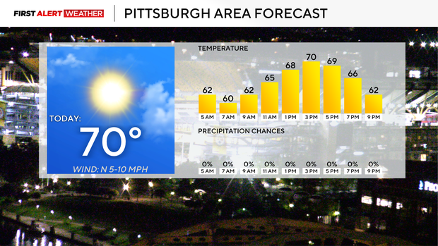
At least we are going to get a couple of dry days in a row here, with both today and Tuesday expected to be dry. Today will be sunny but not very warm, with highs just around 70 degrees. Winds will be breezy, coming in from the north around 5 - 10 mph. Dew points will be low both today and tomorrow. It'll be a fantastic time to get out and walk the dogs or to just take a long, comfy walk. I have noon temperatures in the mid 60s and morning lows today were in the mid 50s.
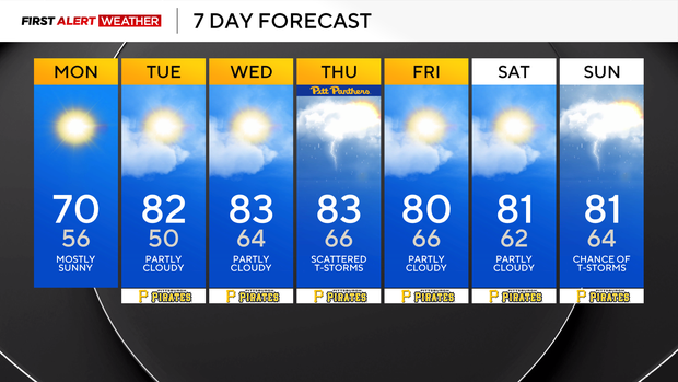
The coolest weather of the week will happen on Tuesday, with morning lows dipping to near 50 in Pittsburgh and a number of places seeing lows in the 40s. Brrrr. Tuesday highs will be in the low 80s, so we will warm up fairly quickly. Expect skies to be partly cloudy with winds out of the south at 5 - 10 mph.
Rain chances over the next week appear to be highest on Thursday and Sunday, with scattered rain expected for both days. Highs will be in the low 80s for most of the week, with morning lows in the mid to low 60s.
Not too bad for the final week of summer. Fall begins at 8:05 p.m. next Tuesday.


