Pittsburgh slowly but surely finds its way out of the deep freeze, but more snow is looming


Skies cleared out, leaving most of the Upper Ohio Valley with ample sunshine Sunday afternoon and evening.
As a result, temperatures responded to the sun, briefly warming into the low 20s, ending our 6-day stretch of high temperatures in the teens in the Pittsburgh metro.
First Alert: None
High pressure, light winds, clear skies, and dry air will once again allow temperatures to drop like a rock through the overnight hours, so Monday morning will once again be very cold with lows on either side of 0 degrees Fahrenheit. Wind chills will not be a major issue due to light winds.
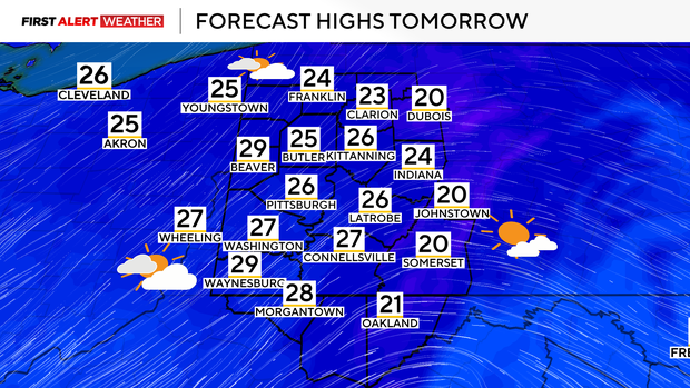
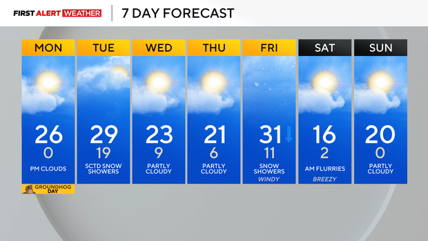
Southwest winds at the surface will allow for some slight warming Monday afternoon and evening, with temperatures reaching the low to mid 20s area-wide.
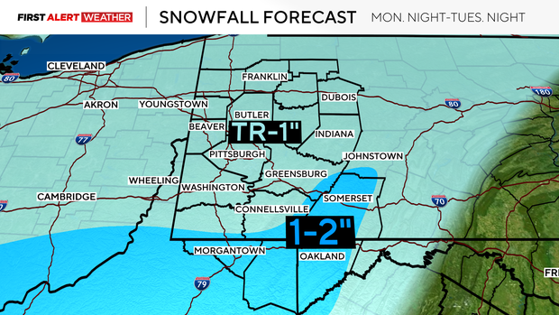
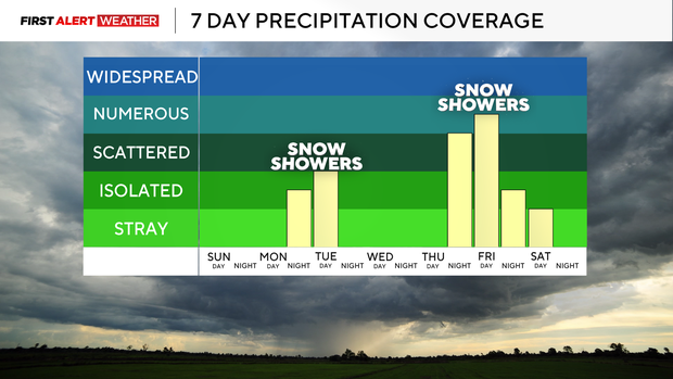
Clouds will increase through the afternoon and evening ahead of a weak disturbance that will head our way from the Cornbelt. This will lead to a chance of light snow showers beginning Tuesday morning, areawide.
The "strongest" lift with this disturbance is likely to pass mostly into West Virginia, so this is where the best chance of light accumulation of snow will occur. Most of our area will receive a trace to less than 1 inch of snow, while areas south of I-68 and into the Laurels may receive 1-2 inches.
Temperatures will drop behind this system on Wednesday and Thursday in the wake of a cold front with highs in the low 20s and lows in the teens and single digits.
A stronger clipper system and cold front are still expected to traverse our region on Friday & Friday night. This will bring higher coverage of snow showers, light-minor accumulation, gusty winds and colder air.
This surge of cold air will likely be much briefer compared to the wave we just came out of. While temperatures are expected to remain below normal through Feb. 13, there are indications of a large-scale pattern shift toward mid- and late-February that will at least bring more normal or even slightly above-normal temperatures.
Stay up to date with the KDKA Mobile App – which you can download here!