Chillier air takes over Pittsburgh region; scattered snow showers, flurries expected through Wednesday
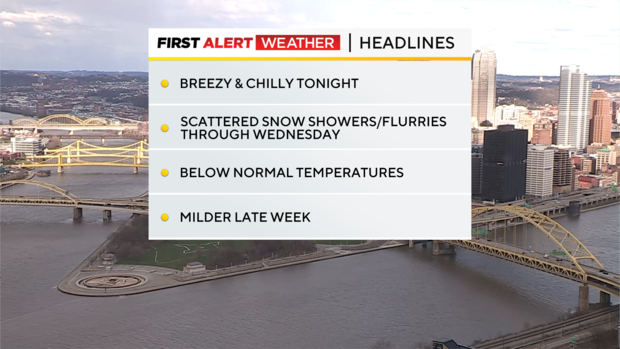
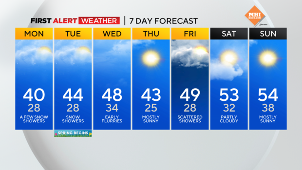
PITTSBURGH (KDKA) - Chillier air has arrived, and we'll take another step down in temperatures tomorrow, with highs only reaching the 40s most days this week.
WEATHER LINKS:
Current Conditions | School Closings & Delays | Submit Your Weather Photos
Daily average High: 49° Low: 30°
Sunrise: 7:27 a.m. Sunset: 7:30 p.m.
FIRST ALERT: None
AWARE: Rain/snow showers Monday-Wednesday
Interestingly, we've been warmer than normal so many days this winter, and now, spring arrives Tuesday evening and we'll have cooler-than-normal temperatures most of this upcoming week!
A few rain/snow showers are already appearing on the radar heading into Sunday evening. That activity will stick around Monday and Tuesday, with breezy conditions, and chilly temperatures.
Our snowfall this winter has been way below normal (just like last winter), but lake-effect snow showers tonight through Wednesday will try to leave some of the slushy white stuff along I-80 and into the Laurel Highlands and Ridges. The best chance for anything to accumulate in those areas will be tonight and Monday, but we'll see melting during daylight hours.
Some of the highest elevations of the Laurels could see one to three inches of snowfall, but much of it will melt. Still, expect wintry feeling conditions the next two days before temperatures start to moderate late week, and we hover near 50 at week's end, which is normal for this time of year.
Stay updated with the KDKA Mobile App – which you can download here!