Pittsburgh's chill remains in place through Sunday, rain expected on Friday afternoon

There's a lot to talk about as chilly weather has moved in.
This is a major pattern shift from where we were in April. It's now official: April 2026 is the hottest on record for daily average temperature. We smashed the record by nearly a degree at 58.2°. The old record was 57.3°, set in 2017. This year overall, has started off very warm.
Through April, we've already seen eight 80-degree days. That's tied for the third most through April on record. We've had 25 days with highs in the 70s. That's the most ever on record. By average temperature, this is the third-warmest start to spring on record. Thanks to the Pittsburgh NWS office for getting us those stats.
While we have been warm so far this year and likely will be very warm to end the year, May is not going to get off to a warm start.
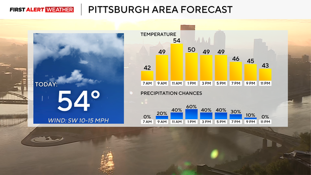
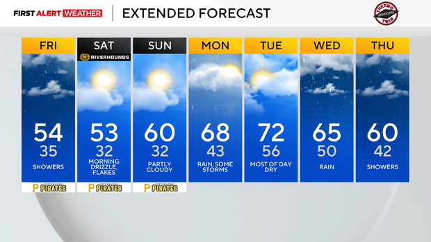
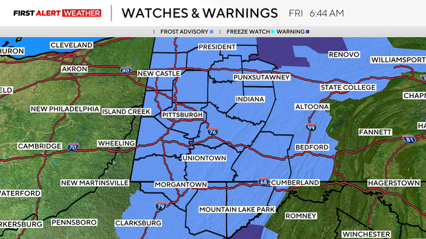
The next two weeks should see normal to near-normal temperatures, and chances are higher that temperatures will be below average than the chance for us to see above-average temperatures over the next two weeks. Frost will be possible today, Saturday, and Sunday mornings due to a pool of cool air that will be in place. Each morning will see temperatures easily dipping into the 30s.
Some communities will see the 20s on Saturday and or Sunday.
Highs during this stretch will hit the mid-50s today and Saturday. Sunday highs will be near 60. Sunday will be dry, but expect light afternoon showers this afternoon, with the highest chance occurring from 1 p.m. through 7 p.m. I expect around a tenth of an inch of rain for most places, but communities up along I-80 could see up to a half inch of rain.
Light drizzle and maybe even some light snow is expected on Saturday morning into the afternoon. Snow will have no impact on drivers.
Temperatures will warm up next workweek with highs hitting the 60s most days.
I have the hottest day of the week happening on Tuesday with highs in the low 70s. Our highest rain chance over the next week looks to be on Wednesday.