The weekend ends with brisk, cool temperatures, but snow looms this week in Pittsburgh

On Monday, fairly quiet weather is expected.
While sunshine will be limited to peeks of it "here and there," we won't have much to complain about, other than the continued cool feel to the forecast.
This all changes Monday night through Tuesday morning. A developing winter disturbance will gather moisture and mix the ingredients for measurable snowfall before and during the Tuesday morning commute.
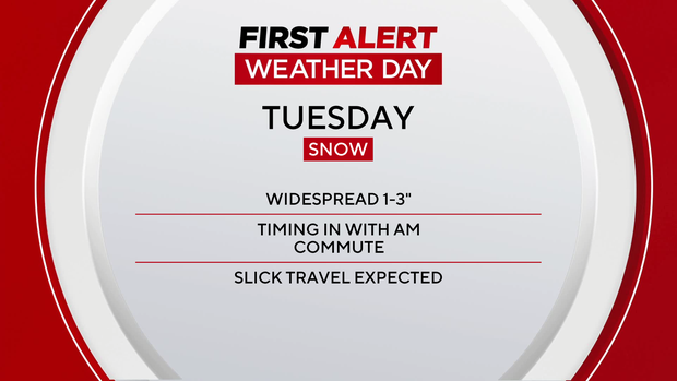
The prospects for slow and slick travel are prompting a KDKA First Alert Weather Day for Tuesday, based on the timing of this system.
Here is how it looks to unfold:
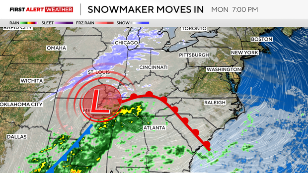
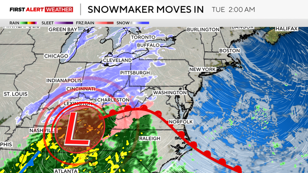
Late Monday night and Tuesday morning, snow showers will start to fly. Pre-dawn Monday, some of the heaviest snowfall rates are expected.
At times, 1 inch per hour could be coming down, making it difficult for road crews to keep up with the roadways before the morning commute and school bus runs.
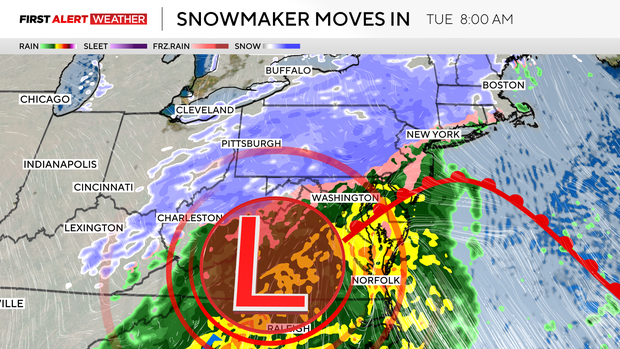
This snow is expected to continue through the morning commute before starting to lighten up and ultimately ending around lunchtime.
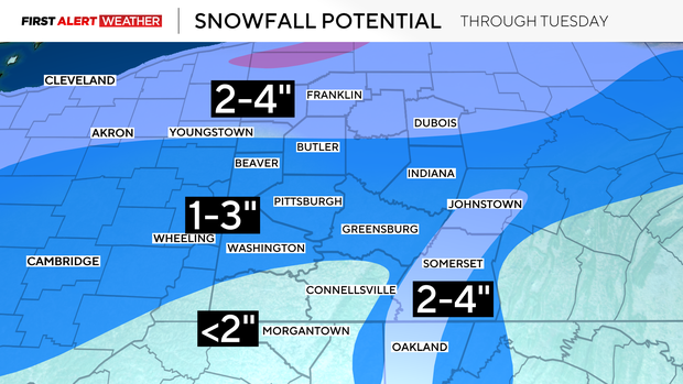
A widespread 1-3" is possible for a good portion of the area, with areas to the north and in the highest ridges getting 2-4".
While this may not sound like a lot of snow, these accumulations will happen in a relatively short time, and that is where we could have issues with the early commute.
Road crews should have ample time during the afternoon to make the late commute a much better experience.
WEATHER LINKS:
Current Conditions | School Closings & Delays | Submit Your Weather Photos


