Summer-like weather continues Friday in Philadelphia, much-needed rain on the way. See the forecast.

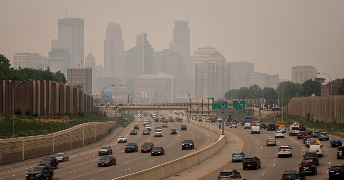
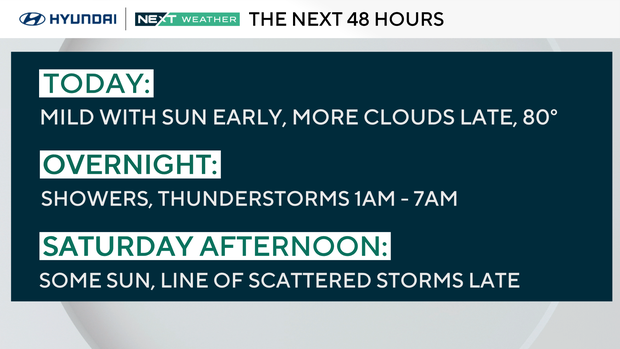
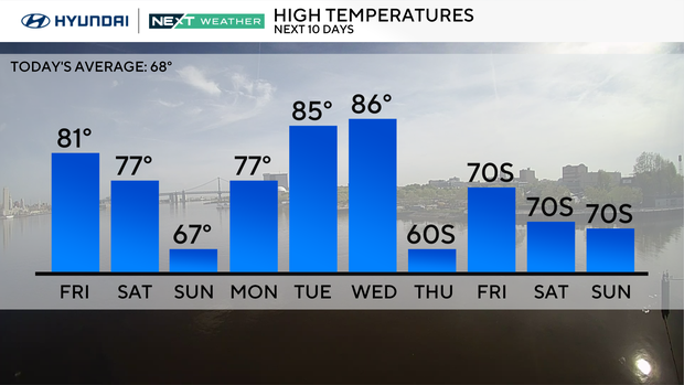
Smoke from the Jones Road Wildfire will be pushed north today as a south wind brings warm air into the area, and skies will become partly sunny. Temperatures will once again hover near 80 as our summer-like pattern hangs on to end the week.
Unfortunately, the summer-like pattern, combined with low humidity and continuing drought conditions, will persist in South Jersey through Friday. Finally, some much-needed rain and thunderstorms arrive Saturday, helping to ease the fire conditions in South Jersey.
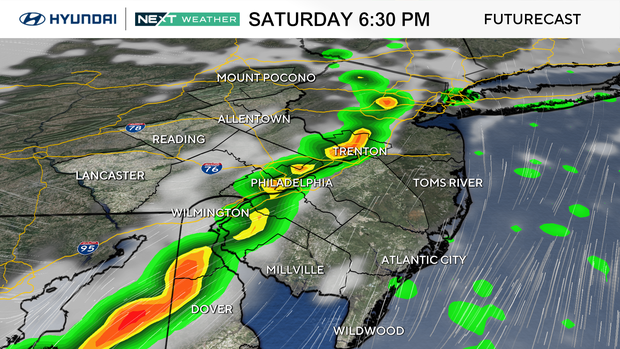
By Friday night, a cold front will approach, triggering showers and storms overnight through Saturday afternoon. It won't be an all-day washout; there will be breaks in the rain with a few scattered downpours. Rain totals will range from 0.25 inches up to 1 inch under any thunderstorms. Temperatures will remain on the warm side, with highs in the upper 70s (only in the 60s at the Jersey Shore).
The rain is expected to end by Saturday evening, and skies will clear overnight as cooler, drier air arrives behind the front.
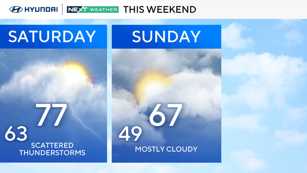
Sunday will be cooler with more clouds, especially to the north, a gusty northwest wind and highs in the upper-60s to low 70s.
By Monday, we are expected to head back into the upper 70s. Tuesday and Wednesday will be the warmest days of the year so far, with highs in the mid-to-upper 80s and temperatures approaching 90 degrees in some places.
Here's your 7-day forecast:
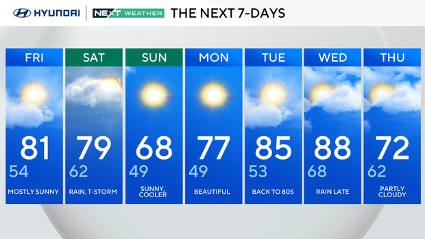
Friday: Mostly sunny. High of 81, low of 54.
Saturday: Rain, thunderstorm. High of 79, low of 62.
Sunday: Sunny, cooler. High of 68, low of 49.
Monday: Beautiful. High of 77, low of 49.
Tuesday: Back to the 80s. High of 85, low of 53.
Wednesday: Rain late. High of 88, low of 68.
Thursday: Partly cloudy. High of 72, low of 62.
Get the latest weather info on the CBS News Philadelphia app.