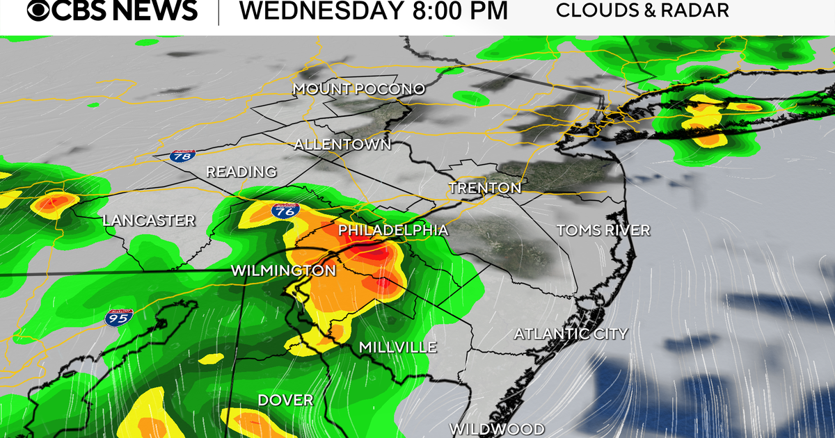
Severe thunderstorm watch canceled for Philadelphia region Wednesday night
A severe thunderstorm watch for the Philadelphia region was canceled Wednesday night.
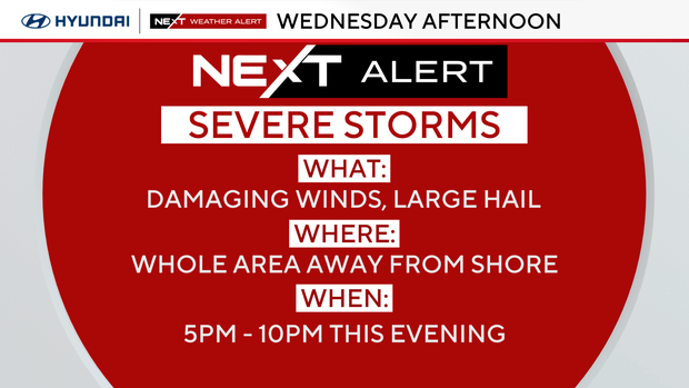
The storms weakened a bit as they approach our area, but the threat for damaging straight-line winds between 60-70 mph — and large hail — will be especially notable in areas to the west of Philadelphia.
There was also a risk of an isolated tornado.
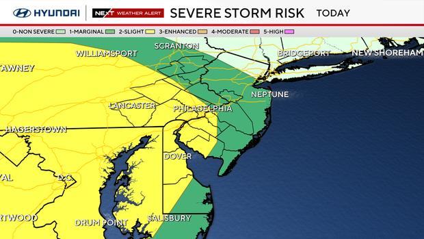
The much cooler marine air should keep strong storms from impacting the shore points.
NEXT big weather changes
We have a sharp turn to colder air, with a front causing temperatures to drop 20-30 degrees between Wednesday afternoon and Thursday afternoon. The front will trigger scattered severe storms and much of the area is under a Level 2 severe risk.
The cold air arriving with the front may be cold enough for rain changing to a wintry mix or snow showers, but no accumulation is expected.
The shocking drop in temperature continues, with Friday struggling to reach 50.
After Wednesday, 70-degree temperatures aren't in the immediate forecast for the next week.
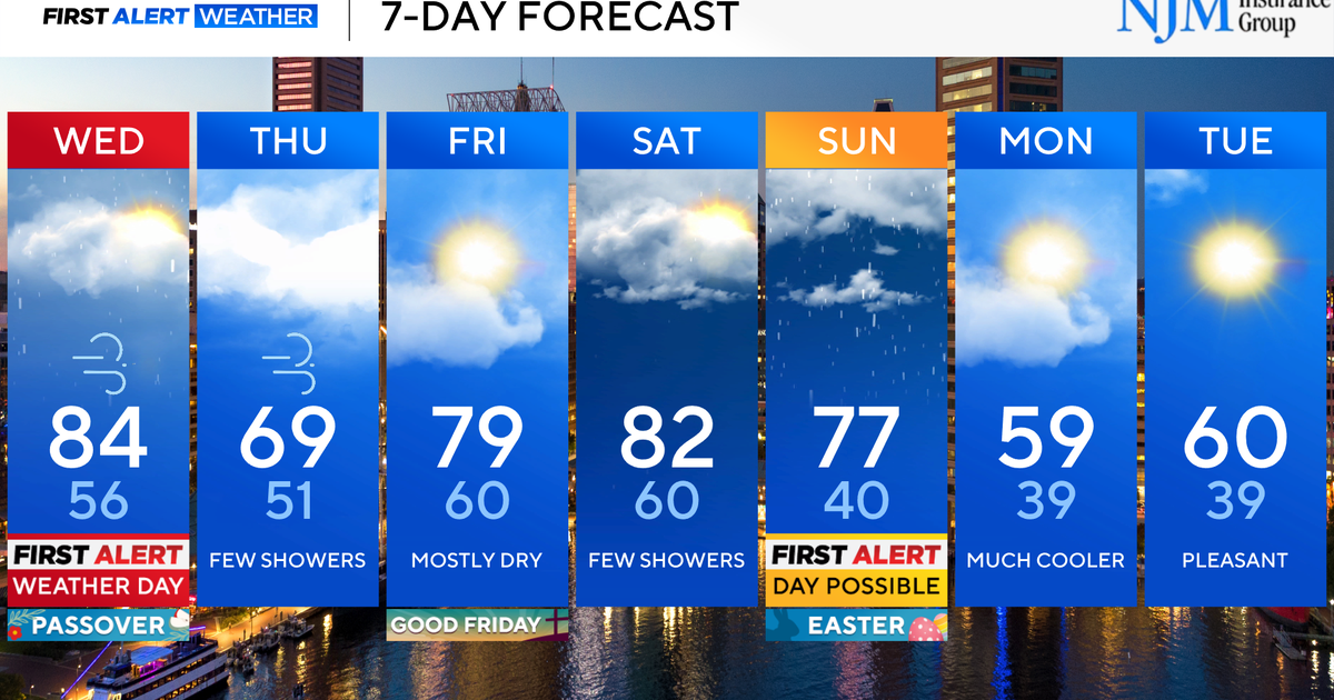
Here's your 7-day forecast:
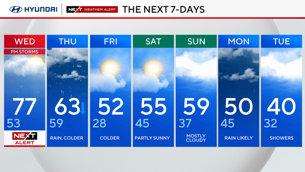
Wednesday: NEXT Weather Alert for p.m. storms. High 77, low 53.
Thursday: Rain, colder. High 63, low 59.
Friday: Colder. High 52, low 28.
Saturday: Partly sunny. High 55, low 45.
Sunday: Mostly cloudy. High 59, low 37.
Monday: Rain likely. High 50, low 45.
Tuesday: Showers. High 40, low 32.