Tornado in South Jersey last week had wind gusts up to 95 mph; storms also produced gustnado

The National Weather Service shared new information on Monday about the tornado that damaged property in New Jersey, and said that a gustnado also formed during the powerful storms.
A gustnado is an area of swirling winds that is kicked up along the leading edge of a thunderstorm or gust front. They are typically relatively short-lived and ground-based, and not actually connected to the thunderstorm like a tornado.
The NWS said the tornado on Friday that started in Williamstown, Gloucester County, and ended in Collings Lake, Atlantic County, was an EF-1 storm.
According to the NWS, the tornado had estimated peak winds at 90-95 mph and traveled 8.6 miles. The tornado had a maximum path and width of 300 yards and lasted about 11 minutes.
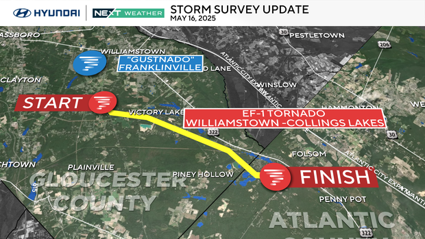
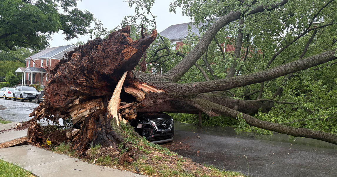
The NWS said the tornado started in Williamstown near the intersection of Janvier and Tuckahoe roads, where a large hardwood tree fell and some siding off the corner of a house peeled off.
According to the NWS, the tornado moved southeast toward Birch Avenue, and several hardwood trees were snapped off their trunks. The NWS said the tornado likely grew to 300 yards in width at Birch Avenue. The tornado also snapped a telephone pole near the intersection of East Piney Hollow Road and US Route 322 before moving to Collings Lakes.
Collings Lakes residents told CBS News Philadelphia that they're feeling grateful no one was injured after the storm ripped through their community.
The gustnado happened around the same time of the tornado, according to the NWS. It had peak winds of 100-105 mph and traveled about 100 yards.
The brief gustnado started in the area of North Blue Bell Road near Coles Mill Road, according to the NWS. The storm snapped several trees in the area.
The NWS said an analysis of radar data showed a "strong signature of a rear-flank downdraft in the vicinity," which likely caused the gustnado.