Sunny, cool Thursday in Philadelphia region, colder weather on the way. Here's the forecast.
Our chilly weather has begun, and we're expecting another weak cold front to move through late Thursday with only a few spotty showers in the Philadelphia region.
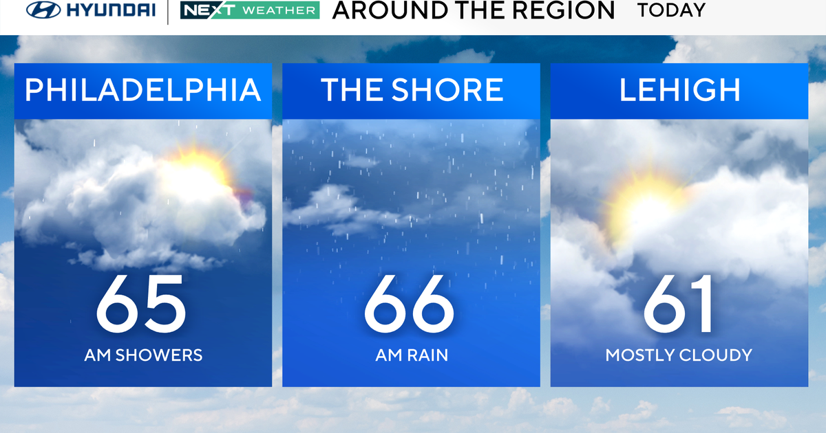
Thursday starts off chilly and brisk with highs only in the low 60s. Most of us will have a sunny day, but there may be some midday clouds, especially in our northern and western zones, thanks to an upper low over the Great Lakes region.
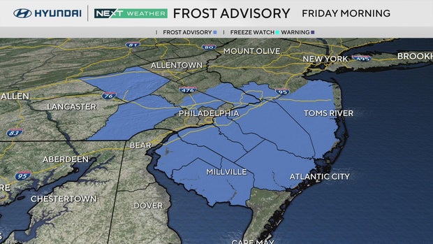
We'll have even more of a chill as high pressure returns Friday, bringing sunshine and cooler, calmer weather into the weekend. Frost advisories have already been issued across most of South Jersey and parts of Pennsylvania due to these chilly temps.
The coldest air of the season will drape over the Delaware Valley with lows in the city near 40 degrees by the end of the week with widespread mid-low 30s in the suburbs.
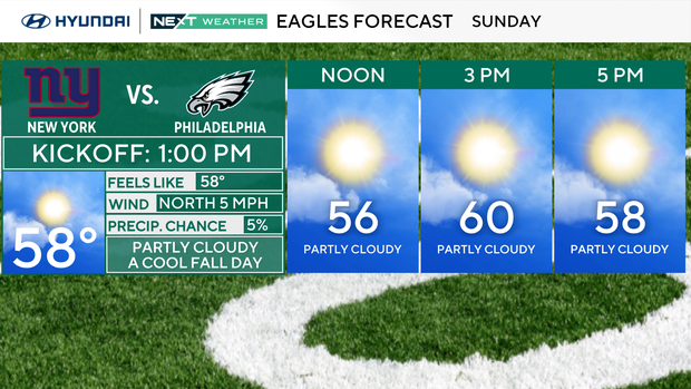
The weekend is trending dry and cool, good fall football weather for the Eagles game on Sunday. Be sure to bring a coat if you're spending time outdoors, but go ahead and leave the umbrella at home.
Our next chance of rain doesn't arrive until next Wednesday, meaning our drought conditions will likely worsen with the release of the weekly drought monitor on Thursday.
Your NEXT Weather team will have that for you once it's revealed.
Here's your 7-day forecast:
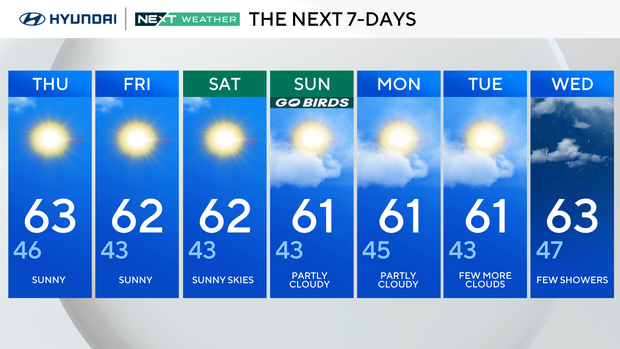
Thursday: Sunny. High 63, Low 46.
Friday: Sunny. High 62, Low 43.
Saturday: Sunny skies. High 62, Low 43.
Sunday: Partly cloudy. High 61, Low 43.
Monday: Partly cloudy. High 61, Low 45.
Tuesday: Few more clouds. High 61, Low 43.
Wednesday: Few showers. High 63, Low of 47.