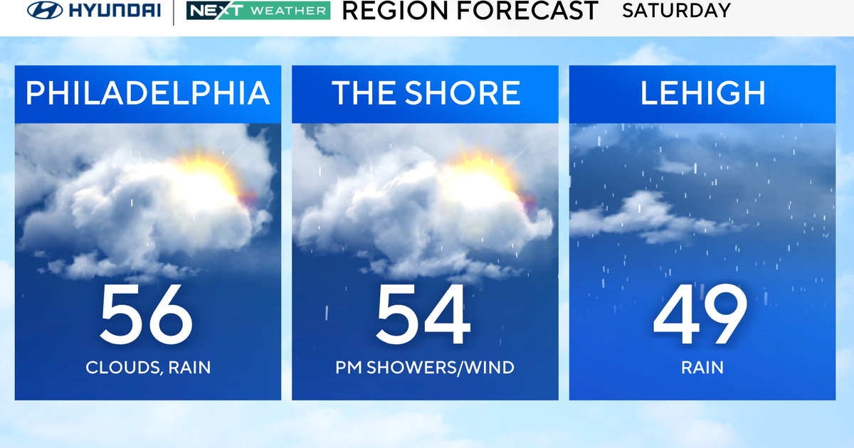
Philadelphia Weather: Plummeting Temperatures Expected As Arctic Cold Front Pushes In
PHILADELPHIA (CBS) -- An arctic cold front will sweep in late Friday afternoon, bringing a bitter cold start to what is shaping up to be a windy, wintry weekend. That front will force temperatures to plummet from the low 40s midday to the teens and single digits overnight.
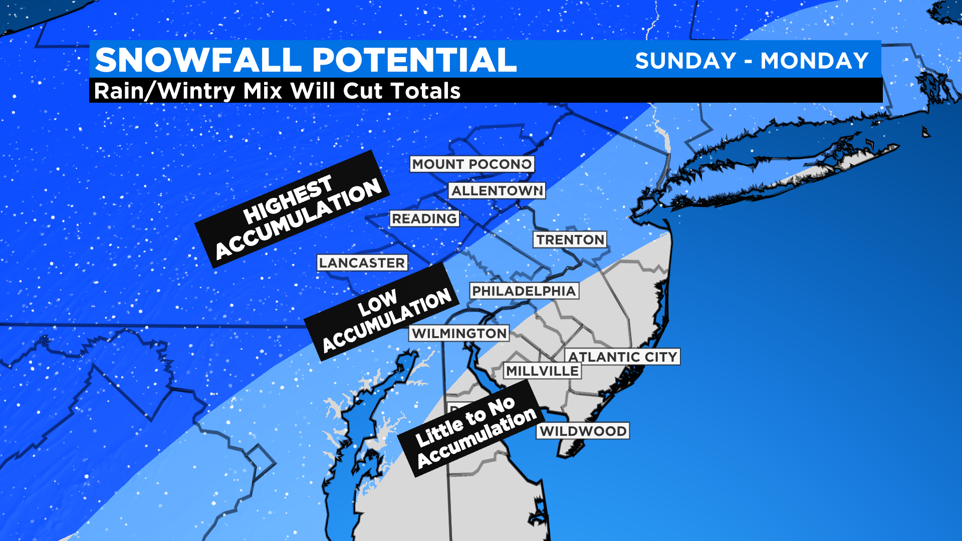
Uncertainties about precipitation type still exist due to the exact track of the storm. Some parts of the area will see heavy, wet snow while others will see rain or sleet.
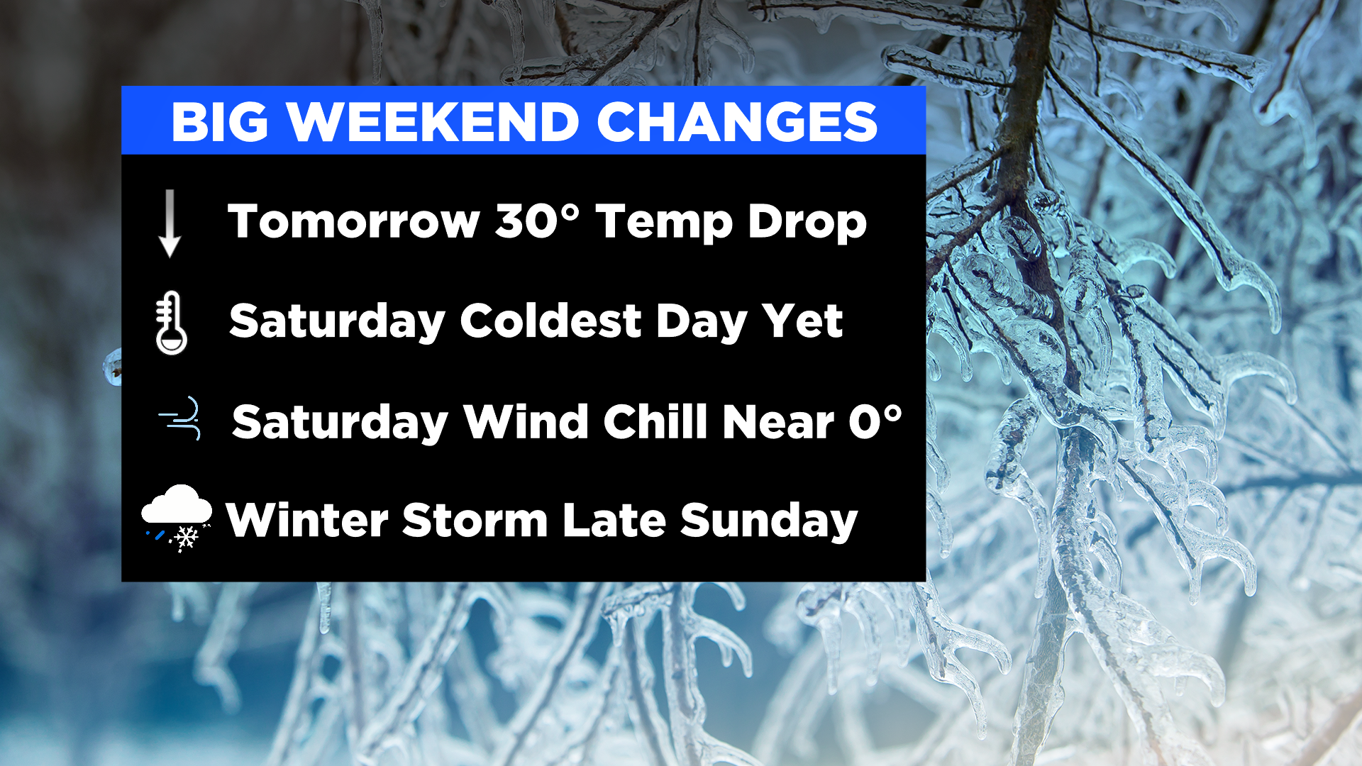
Everyone across the region will experience the dangerous cold and strong winds over the holiday weekend.
Here is the current timeline.
Sunday evening as the storm approaches, we will likely see light snow across the entire area. The exception is down the shore and in southern Delaware, where sleet or rain will fall.
Sunday after midnight and before sunrise Monday, warmer air will wrap into the storm and the snow will change to sleet and rain east of the Lehigh Valley, including the I-95 corridor, Philadelphia, South Jersey and northern Delaware.
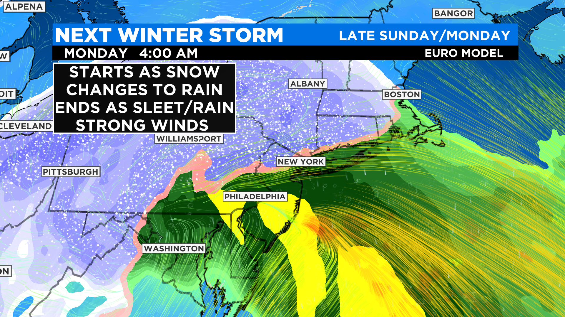
Heavy, wet snow will continue across the Poconos and Lehigh Valley, where significant snow accumulation is possible.
As the storm tracks away late Monday morning, strong winds will develop. Gusts will be 30-40 mph in Philadelphia and could reach warning criteria down the shore where 50-plus mph gusts may be possible.
Coastal flooding is also a possible concern.
Because the current storm track is inland over Philadelphia, the heaviest snow will be farther west across the Lehigh Valley, Berks County and the Poconos.
Should the track shift farther east, the heavier snow bands will cross near the I-95 corridor and Philadelphia.
CBS3's Tammie Souza and Llarisa Abreu contributed to this report.