Philadelphia Weather: Record High Temperatures Across Region In The 70s With Severe Thunderstorm Potential This Evening
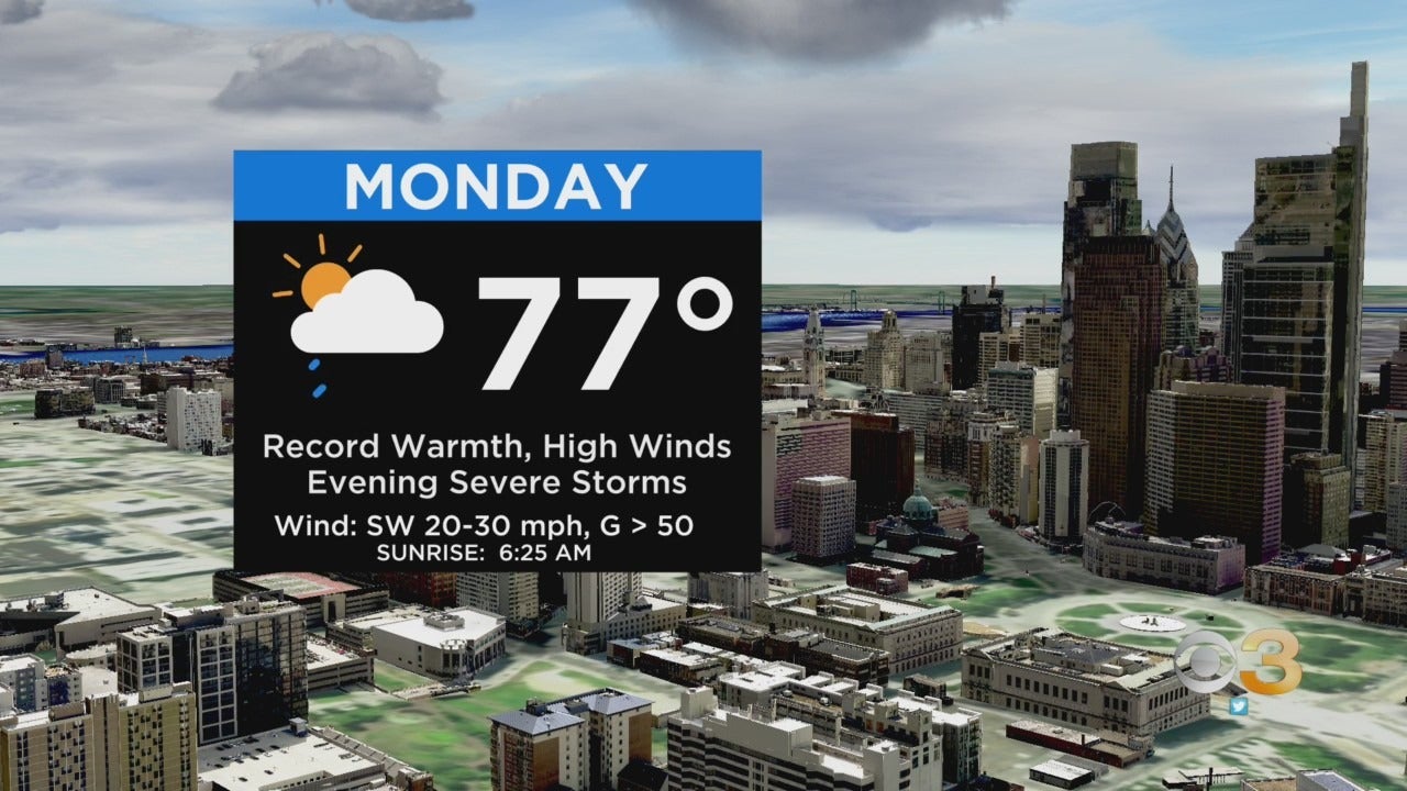
PHILADELPHIA (CBS) - On Monday, we will experience a trifecta of big weather events including record high temperatures, high winds, and possible severe storms. After a warm start to the morning in the 50s and 60s, southwest winds will push today's temperatures to new record highs in the mid and upper 70s.
- Philadelphia: 74, 1974
- Wilmington: 73, 2009
- Reading: 73 1921
- Allentown: 70, 1974
- Atlantic City: 75, 1974
- Mt. Pocono: 63, 2000
- Georgetown: 75, 1961
- Trenton: 72, 1946
Winds will also be gusting as high as 40-50 mph Monday afternoon and a Wind Advisory is in effect for the entire area from noon Monday through 1 a.m. Tuesday.
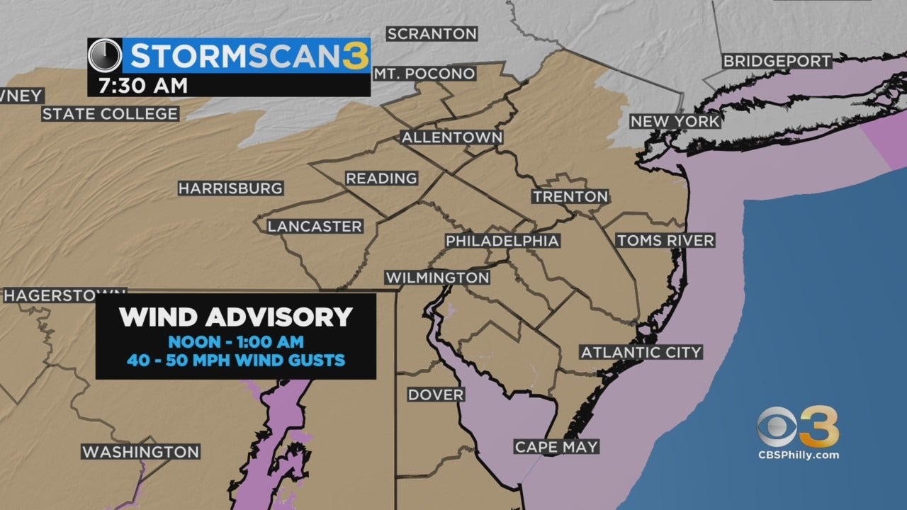
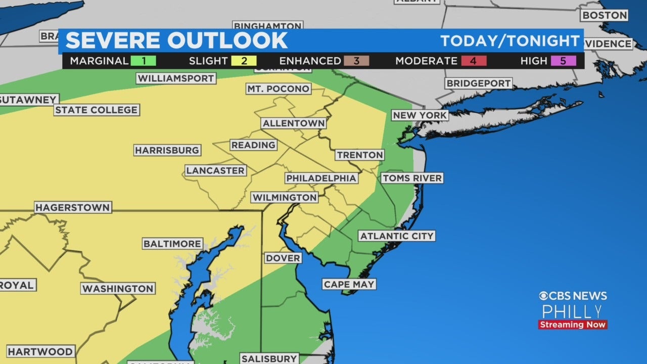
Finally, the Storm Prediction Center has placed us under a Slight Risk for severe storms on Monday. A line of thunderstorms may form to the west and move from the Poconos to the Shore between 4 p.m. and 9 p.m. Some of these storms may produce damaging winds. There will also be brief heavy downpours leading to some urban street flooding. The evening commute could be a wet and long one if you are caught under any storms.
Following the passage of this evening's storms and cold front colder air arrives and our temperatures will tumble to the upper 30s by daybreak Tuesday. That is a 35-40 degree drop from today's high. Tuesday will be partly to most sunny and at least 25 degrees cooler in the low 50s.
OVERVIEW:
- Very warm start this morning and temperatures climbing quickly on southwest winds will reach to 70s area-wide with exception of Poconos in the 60s.
- Winds ahead of approaching line of storms and cold front will gust to 50 mph ushering in rapid warmth.
- Fast moving line of storms between crosses from Poconos to the Shore between 4-9PM.
- Temperatures fall drastically behind the front with Tuesday morning lows in the upper 30s. (A 35-40 degree drop)
- Sunny and mild Tuesday near 50.
- More rain Wednesday that may start as a brief wintry mix in the morning. Highs in the mid 40s.
- Clouds and a shower Thursday, Friday, Saturday. All in the 50s.
- Daylight Saving Time begins Sunday and sunset will be at 7:06 PM