Summerlike weather expected Monday in Philadelphia area, tracking midweek rain. Here's the forecast.

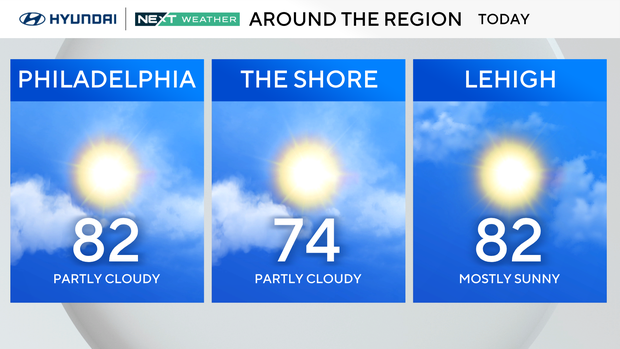
Philadelphia is starting the week on a warm note with elevated humidity for mid-September.
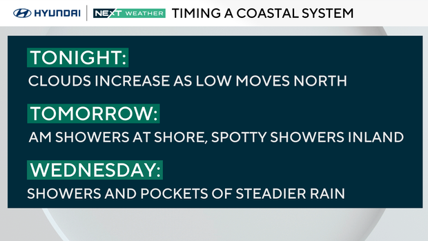
We started with sunshine and a blue sky, but later today clouds increase from south to north as a coastal low develops off the Carolinas.
Most areas remain dry during the day, but onshore flow keeps highs cooler near the coast, mainly in the 70s, while inland spots reach the upper 70s to low 80s.
Rain returns
Unsettled weather takes over Tuesday through Wednesday as the offshore low drifts north. Morning showers at the shore on Tuesday should diminish as they move inland, but we can't rule out a spotty shower.
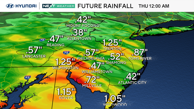
Wednesday looks like the more active day as clouds and periods of showers will affect the region, especially across southern Delaware and South Jersey, where rainfall could be heavier. Winds will also increase along the coast, with gusts near 30 mph Tuesday into Wednesday.
By late Thursday, the system moves away, leading into a drier stretch. Temperatures surge into the mid-80s on Friday before a backdoor front knocks us back to the 70s over the weekend.
This weekend is the last weekend of the summer. Fall officially begins at 2:19 p.m. on Sept. 22.
Here's your 7-day forecast:
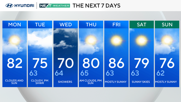
Monday: Clouds and sun. High 82, Low 62.
Tuesday: Cloudy, P.M. shower. High 75, Low 63.
Wednesday: Showers. High 70, Low 64.
Thursday: A.M. clouds, P.M. sun. High 80, Low 65.
Friday: Mostly sunny. High 86, Low 63.
Saturday: Sunny skies. High 79, Low 63.
Sunday: Mostly sunny. High 76, Low 62.


