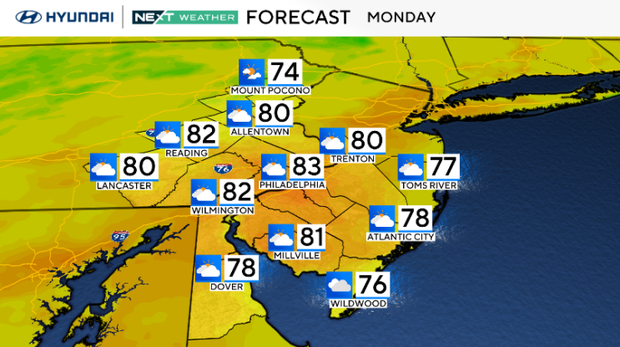
Mostly cloudy, warm Monday in Philadelphia region. Here's the weather forecast.

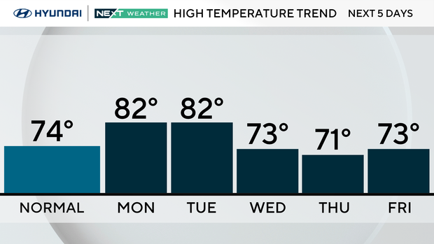
A pleasantly mild Monday is underway with highs in the 70s and low 80s, with clouds thickening, courtesy of Tropical Storm Imelda to our south. While a stray shower could creep into southern Delaware, most of our region will stay north of Imelda's rain.
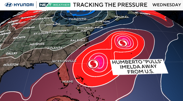
By Tuesday, both Humberto and Imelda will be passing well out to our southeast. The main impact here will just be some extra high clouds, while a strong cold front approaches from the northwest. That front moves through Tuesday night, bringing in a fresh north wind and knocking temperatures back.
One thing to note: rip currents and rough surf will be felt on and along all beaches and shore points. Boaters should proceed with caution and pay attention to any alerts that may be issued.
Wednesday feels like fall, with highs near 70 and a gusty breeze as Canadian high pressure builds in. That high will lock in cooler, dry weather through the end of the week. By the weekend, the air mass moderates and temperatures gradually climb back toward the mid and upper 70s.
Here's your 7-day forecast:
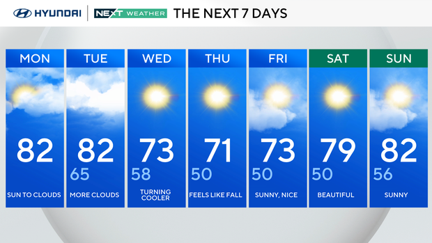
Monday: Sun to clouds. High 82, Low 65.
Tuesday: Cloudy skies. High 82, Low 65.
Wednesday: Turning cooler. High 73, Low 58.
Thursday: Feels like Fall. High 71, Low 50.
Friday: Sunny, nice. High 73, Low 50.
Saturday: Beautiful. High 79, Low 50.
Sunday: Sunny. High 82, Low 56.