Chilly Friday weather with temperatures feeling like the 20s in the Philadelphia area. Here's the forecast.
After a few light snow showers early Friday morning left a light dusting to start our day, the sunshine will break through the clouds and give way to a mix of sun and clouds this afternoon.
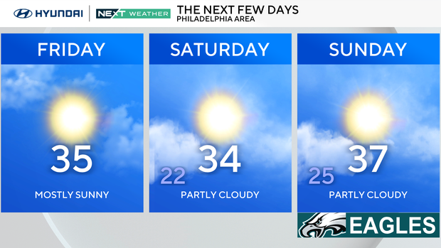
Despite some periods of sunshine, temperatures will remain cooler than normal with highs only in the middle 30s.
And while the wind isn't as gusty as it was yesterday, there will remain enough of a breeze in the air today to keep feels-like temps in the 20s all afternoon.
NEXT big weather change
The cold trend will continue through the weekend with high temperatures remaining in the mid-upper 30s and low temperatures in the low-middle 20s.
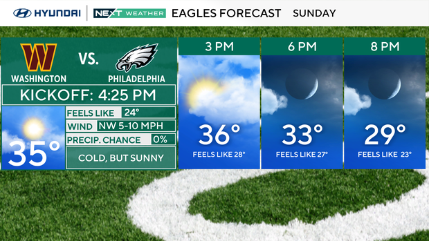
In the Eagles' final game of the regular season on Sunday, it will be cold but sunny.
Next week will start off chilly with 20s in the morning and highs in the middle 30s, but the 40s will return by Tuesday.
In fact, a warmer trend looks to lead us through the majority of next week with high temperatures running near or even slightly warmer than normal. High temperatures next Wednesday will be in the low 50s, but it'll also come with a chance for a few scattered showers.
The longer-term forecast (8-14 days) has a chance for more above normal temps, meaning our cold pattern will likely be shifting.
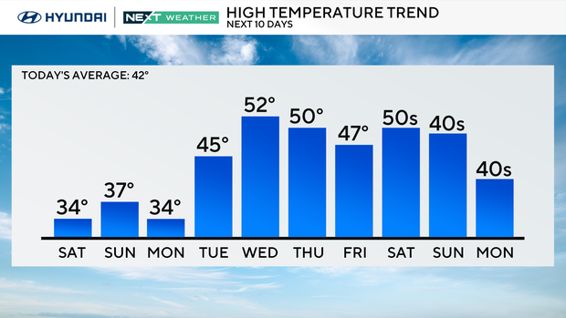
It also means the snow chances will decrease a bit with precipitation chances in the form of rain increasing.
Here's your 7-day forecast:
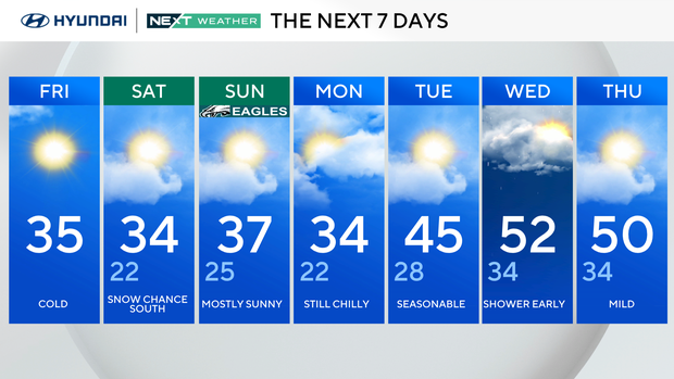
Friday: Cold. High 35
Saturday: Snow chances in the southern parts of our region. High 34, Low 22
Sunday: Mostly sunny. High 37, Low 25
Monday: Still chilly. High 34, Low 22
Tuesday: More seasonable! High 45, Low 28
Wednesday: Shower chances early in the day. High 52, Low 34
Thursday: Mild weather. High 50, Low 34