Canadian wildfire smoke will make the Philadelphia region hazy again on Wednesday. Here's the forecast.
Canadian wildfire smoke along with high clouds blanketing much of the Philadelphia region will lend a hazy appearance to the sky on Wednesday. This smoke and cloud cover will filter the sun and slightly limit afternoon warmth once again.
The morning will start with a few scattered sprinkles, but those should dissipate by around 7-8 a.m. The light precipitation and an east wind will help keep the smoke elevated, so we shouldn't experience air quality concerns on the ground.
We do have an Air Quality Alert in effect in the Poconos and Delaware, where the haze is limiting visibility.
Temperatures should only top out in the upper 70s and low 80s. It's such a difference from what we experienced in July. In addition, the humidity levels will remain moderately low for this time of year, so at least that's a bonus.
Thursday brings brighter conditions as high pressure noses in from the northwest, and we'll start to warm up, with highs returning to the upper 80s by the weekend.
Other than a stray shower chance, mainly south of the city, we'll be on a fairly dry stretch to start August, with no significant weather maker in sight.
In fact, it's possible that we go a straight 11-12 days without measurable rain, making it one of the driest stretches of the year. The longest dry stretch we had in 2025 was over 13 days in April. The NEXT Weather team will keep you informed of any changes.
Here's your 7-day forecast:
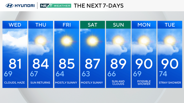
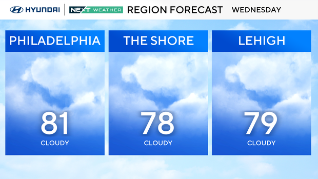
Wednesday: Clouds, haze. High 81, Low 69.
Thursday: Sun returns. High 84, Low 67.
Friday: Mostly sunny. High 85, Low 64.
Saturday: Mostly sunny. High 87, Low 63.
Sunday: Sun and clouds. High 89, Low 66.
Monday: Possible shower. High 90, Low 69.
Tuesday: Stray shower. High 90, Low 74.