Warm Tuesday in Philadelphia region but rain is on the way. Here's the weather forecast.


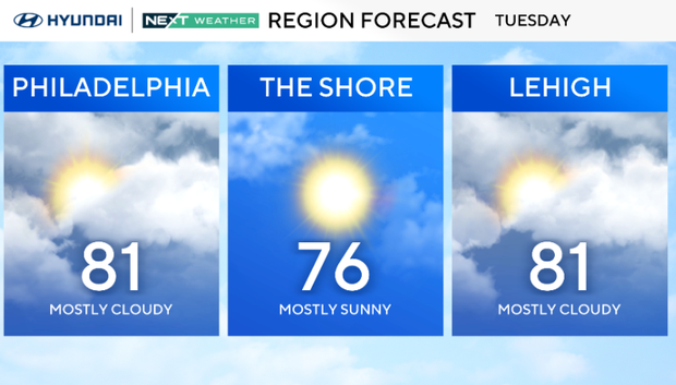
After some morning fog, we'll have some clouds and sun with warmer than normal weather Tuesday.
It should be mostly dry and comfortable, with highs in the upper 70s to low 80s. A few showers may pop up late in the day across far western areas, but widespread rain holds off until later.
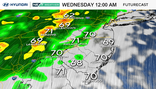
Rain arrives Tuesday night as a cold front pushes through the region. Expect widespread showers and a few rumbles of thunder overnight, but no severe weather. Rain continues into Wednesday, with some showers falling in the morning drive hours.
As a result, the NEXT Weather Team has issued a NEXT Weather Alert as this rain could certainly impact commuters on Wednesday.
This round of rain wraps up by Wednesday evening as the front moves offshore.
Totals around 0.75 to 1 inch are likely, with a few spots seeing more. It'll be noticeably cooler on Wednesday, with highs mainly in the upper 60s and lows dropping into the 40s, even the upper 30s in the Poconos.
The rest of the week looks dry and cool, thanks to high pressure building back in. Thursday night could be the chilliest so far this season. While temps warm a bit heading into the weekend, they'll likely stay below average.
Looking ahead, there's growing potential for a coastal low to develop and bring some unsettled weather by the weekend, but the details remain uncertain — something to keep an eye on as the forecast becomes clearer.
Here's your 7-day forecast:
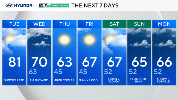
Tuesday: Increasing clouds. High 81, Low 61.
Wednesday: Rain moves in. High 70, Low 63.
Thursday: Much cooler. High 63, Low 45.
Friday: Sunny and cool. High 67, Low 45.
Saturday: Partly cloudy. High 67, Low 52.
Sunday: Chance of rain. High 65, Low 52.
Monday: Cool with showers. High 66, Low 52.