Record lows set in Poconos, temperatures in Philadelphia region very cold Friday. Here's the forecast.


It feels like midwinter in the Philadelphia region, and for a few spots, it even looks the part.
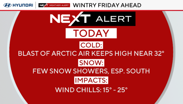
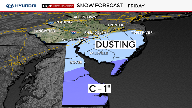
The day began with teens and low 20s, and some light snow slid from Delaware into southern New Jersey during the morning. Philadelphia picked up a few flakes, though nothing that stuck around long.
Areas south of I-95 managed a quick dusting before everything tapered off near midday.
Even with the snow gone, the cold holds on. Temperatures in the afternoon hover near 32, so keep the layers handy. Lows tonight will be in the 20s and low 30s.
High pressure slides offshore tonight while the weak coastal low moves out. Light snow this morning focused on Delaware and far southern New Jersey, with northern areas staying mostly dry. Everything tapers off by afternoon, and as temperatures drop into the 20s and low 30s, a few pockets of drizzle or freezing drizzle may form near and southeast of I-95 this evening.
What's NEXT
Saturday is not as cold, with clouds, some sun and highs in the low 40s. A cold front arrives late Sunday into Sunday night, bringing a brief warmup ahead of it but keeping temperatures below normal. Moisture is limited, though a few light snow showers are possible across east central Pennsylvania and northern New Jersey.
Another cold front will push through the region Sunday night and usher in another round of Arctic air for the beginning of the week. High temperatures Monday afternoon will once again struggle to hit the freezing mark before dropping to the upper teens Tuesday morning.
The unseasonably cold air will lock in for Tuesday before warmer, but still cooler than normal temperatures build into the middle of the week. Going into next Thursday will be our next chance of rain and possibly some snow before another dip in temperatures.
New temperature record in Mt. Pocono, Pennsylvania
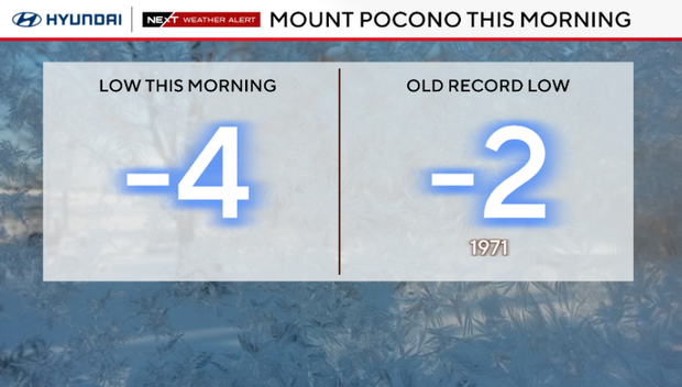
By the way, it was so cold Friday morning that we set a new temperature record! Friday morning's low of -4 degrees beat the previous record in Mt. Pocono, Pennsylvania, by two degrees.
The previous record low for today's date was -2 degrees, and that record has stood since 1971.
Here's your 7-day forecast:
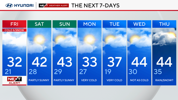
Friday: NEXT Weather Alert for cold and snow. High 32, Low 21.
Saturday: Partly sunny. High 42, Low 28.
Sunday: Sun and cold. High 43, Low 29.
Monday: Very cold. High 33. Low 27.
Tuesday: Very cold. High 37, Low 19.
Wednesday: Not as cold. High 44, Low 30.
Thursday: Rain/snow?. High 44, Low 35.