Flood watch in effect in Philadelphia region Monday as some areas get more than 4 inches of rain


The threat of widespread flash flooding in the Philadelphia area has diminished greatly, but a flood watch will remain in effect Monday until 8 p.m.
Showers and storms Monday were scattered, but any storm could produce localized downpours and lead to the risk of additional flooding, especially in the areas that were hardest hit Sunday night.
According to the National Weather Service, more than four inches of rain fell in Camden, New Jersey, over the last 24 hours. Rainfall totals generally ranged from 2 to 4 inches, with Philadelphia getting just over 4 inches of rain.
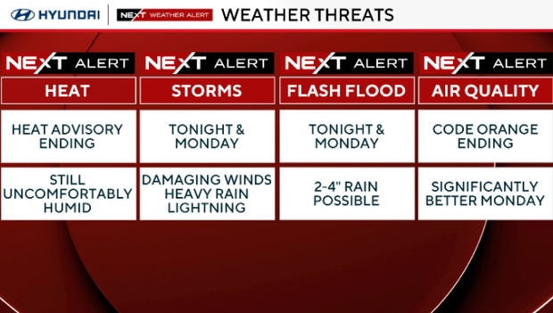
There will be some street flooding, so remember: Turn around, don't drown. Less than 2 feet of water can float your car and carry it away. Power outages are also possible.
How much rain fell in Philadelphia region?
Here are the places in the Philadelphia region with the highest rainfall totals over the last 24 hours:
- Camden, New Jersey: 4.38 inches
- Philadelphia: 4.22 inches
- Washington Township, New Jersey: 3.50 inches
- Bristol, Pennsylvania: 3.50 inches
- Haddon Township, New Jersey: 3.06 inches
- Leesport, Pennsylvania: 3.01 inches
- Woodsville, New Jersey: 3.00 inches
- Sewell, New Jersey: 2.97 inches
- Voorhees, New Jersey: 2.84 inches
- Burlington, New Jersey: 2.83 inches
NEXT big change
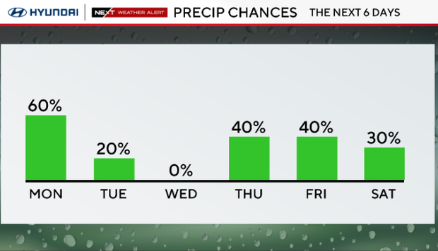
In better news, the heat wave has ended. Temperatures will hang around the 80-degree mark Monday, but there are more showers and storm chances likely each day this week.
Several waves of storms with tropical downpours will cross the area, and some of us will see an additional 2 to 4 inches of rain for a grand total of 3 to 5 inches between Sunday evening and Monday night.
Here's your 7-day forecast:
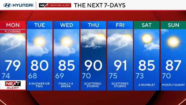
Monday: NEXT Weather Alert for flooding. High 79, low 74.
Tuesday: A shower or two. High 80, low 68.
Wednesday: Finally a break. High 83, low 70.
Thursday: Scattered storms. High 90, low 70.
Friday: Scattered storms. High 91, low 75.
Saturday: A rumble? High 85, low 73.
Sunday: Mostly sunny. High 87, low 70.


