Storms could bring flash flooding, damaging wind gusts to Philadelphia region Tuesday. Here's the forecast.
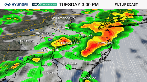
A slow-moving storm system will bring showers and thunderstorms Tuesday in the Philadelphia region.
Multiple rounds of rain may result in localized flash flooding, especially where storms repeatedly move across the same areas.
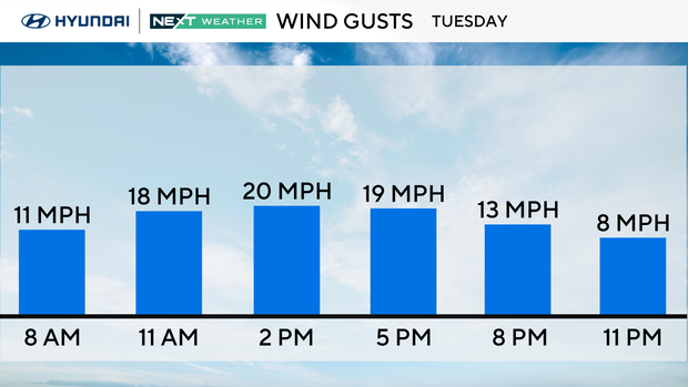
A few storms could also produce damaging wind gusts, and travel conditions might be impacted, as there will be a chance of tornadoes. Charge your devices in case of power outages and plan indoor activities. Also, turn off your irrigation system, as Mother Nature will likely do the job for you.
Unsettled weather continues with scattered showers and thunderstorms as the storm system slowly exits the region Wednesday. While isolated stronger storms remain possible, the overall severe weather threat should gradually decrease through the day.
NEXT big weather changes
Humidity will be high most of the week, and unsettled weather will be around through Thursday, although Tuesday will likely be the greatest risk for strong-to-severe storms.
Temps will also be below normal until Saturday when the high is expected to be in the mid-upper 80s.
Friday and Saturday are trending dry, so weekend plans may be OK for the early weekend. Next week looks to be much hotter again with the potential for another heat wave. The NEXT Weather Team will keep you posted.
Here's your 7-day forecast:
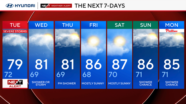
Tuesday: NEXT Weather Alert day for storms. High 79, low 72.
Wednesday: Shower or storm. High 81, low 69.
Thursday: P.m. shower High 81, low 69.
Friday: Mostly sunny. High 86, low 68.
Saturday: Mostly sunny. High 87, low 70.
Sunday: Shower chance. High 86, low 71.
Monday: Shower chance. High 85, low 71.


