All eyes on nor'easter heading toward NYC, Tri-State Area Saturday and Sunday
All eyes are on a nor'easter headed toward the Tri-State Area this weekend.
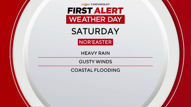
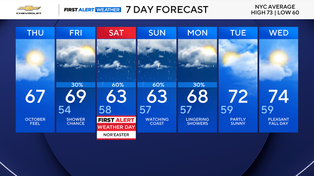
We're set for a First Alert Weather Day for Saturday due to expected heavy rain and potential coastal flooding.
Check the latest weather watches, warnings and alerts
There's still some uncertainty regarding the exact timing of the storm and its overall impact.
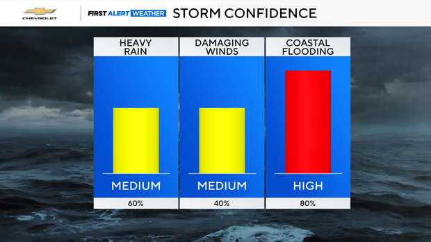
That said, as of Thursday afternoon, the First Alert Weather Team says heavy rains, damaging winds and coastal flooding are all on the table Saturday and Sunday, although the former is of greater concern right now.
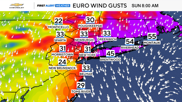
A wind advisory, meaning gusts could reach 50 mph, goes into effect at 2 p.m. Friday and lasts through 6 a.m. Sunday for New York City, Long Island, and Fairfield and Westchester counties.
A high wind watch for gusts up to 60 mph goes into effect Friday evening on the Jersey Shore and lasts through Saturday evening.
There are also high surf advisories for Queens, Brooklyn, Long Island and the Jersey Shore through Saturday. In Queens and Brooklyn, waves could reach 7-9 feet, while on Long Island and the Jersey Shore, they could reach 11 feet.
Showers will develop Friday afternoon into Friday night, with steady rain possible overnight. There will be wind gusts of 30 to 45 mph, with isolated gusts up to 50 mph, and minor to moderate coastal flooding is expected.
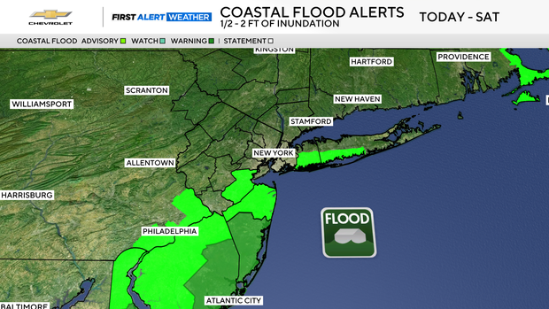
Saturday is what we're watching most closely. We're expecting periods of rain that will be heavy at times. Gusting winds will clock in at 30 to 50 mph, but potentially stronger winds are possible, especially on the Jersey Shore. Again, there's an expectation of minor to moderate coastal flooding.
We'll get more rain Sunday, and again there will be gusting winds up to 45 mph or more. Wind and rain will be heaviest in the morning.
New York City Mayor Zohran Mamdani is urging residents to take steps now to prepare, including moving cars to higher grounds, securing outdoor furniture, clearing debris from drains, keeping batteries charged, and signing up for Notify NYC.
The mayor and the city's emergency management department issued a travel advisory from Friday afternoon through Sunday morning.