Rainy weather with possibly strong storms impacting New York, New Jersey area
It is a stormy start to the weekend, with a rainy Friday that could bring severe weather to the New York area.
Showers will move through the area during the day. But the bigger concern is for the afternoon and evening commute.
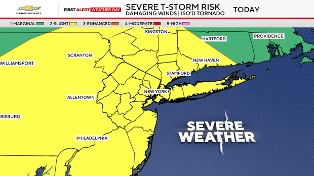
It is a First Alert Weather Day for the threat of severe thunderstorms.
The morning starts damp, with showers and a few isolated downpours.
By lunchtime, things should settle down somewhat. Skies stay mostly cloudy, and while a stray shower is possible, much of the area should stay dry.
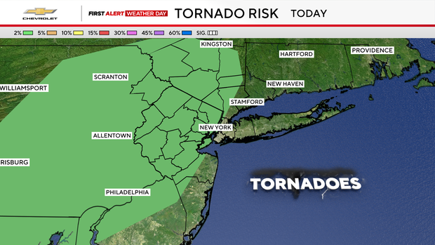
The concern arrives later when isolated to scattered severe thunderstorms could develop as temperatures climb into the low and mid-70s in a warm, humid air mass. The main threat will be straight-line damaging winds, although an isolated tornado cannot be ruled out.
Tonight, leftover showers and thunderstorms remain possible, especially south and east of New York City.
Then the weekend brings a dramatic change.
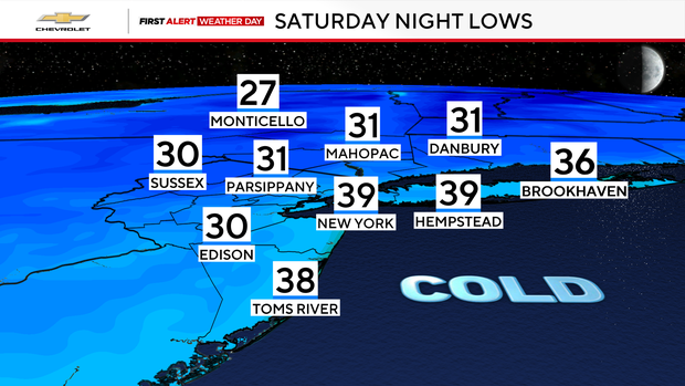
Saturday will be chilly and blustery, with wind gusts of 25 to 35 mph, and highs only in the low to mid-50s, feeling more like November. Saturday night will be the coldest of the season, with the city around 40 degrees, our suburbs in the 30s, and the Catskills in the 20s.
As for Sunday, it will be cool but calmer, with highs in the 50s.


