NYC and Tri-State Area face strong storms, flood watch
Severe weather warnings have started popping up as strong storms make their way through New York City and most of the Tri-State Area.
A tornado warning was issued for northwestern Ulster County, New York, just after 6 p.m. It was canceled just after 6:15 p.m.
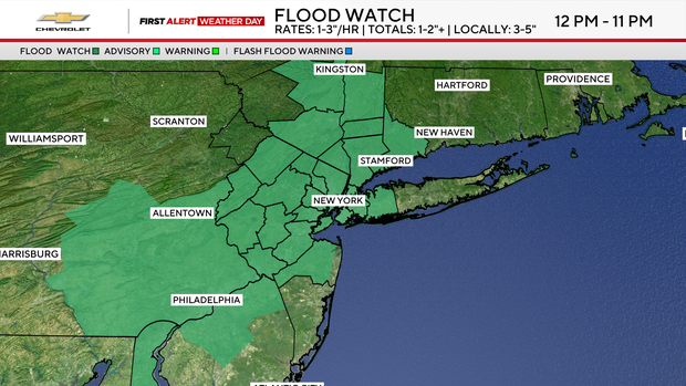
A flood watch was issued for most of the Tri-State Area, including New York City.
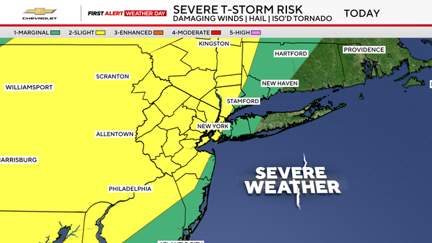
A severe thunderstorm watch has been issued for Bergen, Bronx, Essex, Fairfield, Hudson, Hunterdon, Kings, Mercer, Monmouth, Morris, Nassau, New York (Manhattan), Ocean, Orange, Passaic, Putnam, Queens, Richmond, Rockland, Somerset, Sussex, Union, Warren and Westchester Counties until 8 p.m.
Check the latest weather watches, warnings and alerts
The humid start to the morning has given way to increasing concerns for rain, flash flooding and potentially severe thunderstorms as the day unfolds. That's why it's a First Alert Weather Day.
The flood watch is in effect from noon to 11 p.m. for parts of New York, New Jersey and Connecticut.
There is also a risk of dangerous rip currents from 6 a.m. to 9 p.m. for beaches south of the city and on Long Island.
The morning commute features muggy conditions with temperatures near 70 degrees in the city and in the 60s across surrounding suburbs. While some locations stay dry early, a few isolated downpours are possible, especially around the city and areas north and west.
Our attention then turns to the lunch hour and especially in the afternoon, when thunderstorms become more numerous. Some storms could turn severe, producing damaging winds, large hail and even an isolated tornado. Heavy rainfall rates may also lead to flash flooding, particularly in urban and poor drainage areas.
Rain could fall at 1 to 3 inches an hour, with totals of 1 to 2 inches or more. Higher local totals are expected, with 3 to 5 inches.
Travel during the evening commute, especially through the first half, will likely be impacted by scattered storms and localized flooding.
New York City Emergency Management officials said the city is under a travel advisory due to the weather. They are encouraging commuters to allow for extra travel time, avoid flooded roads and never drive or walk through floodwater.
Those who live in a basement or a below-grade space should be prepared to move to higher ground if conditions worsen.
"Flash flooding, as I've said before, can happen in the blink of an eye. So we're reminding New Yorkers to stay vigilant, keep an eye on the forecast," said Gov. Kathy Hochul.
Conditions gradually improve at night, although lingering showers, thunderstorms and pockets of residual flooding remain possible.
Friday looks somewhat quieter with a mix of clouds and sunshine, along with isolated showers and storms mainly south and east of the city.
The weekend brings a break, featuring mostly sunny to partly cloudy skies and highs in the low 80s.


