Severe storms bring down trees, cause flooding across Tri-State Area

Storms moved through the Tri-State Area on Saturday, causing some damage and flooding.
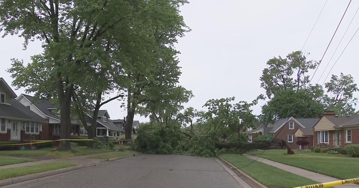
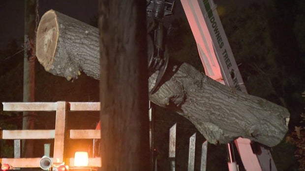
Across the region, there were downed trees and wires, which led to some power outages.
At one point, JCP&L had over 3,000 customers without service, nearly 1,700 customers PSEG Long Island lost service, and PSE&G New Jersey had just over 1,500 impacted customers.
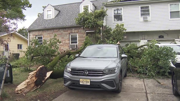
Downed trees cause damage in New Jersey
The burst of wind and rain brought a tree down onto two homes on Roxbury Place in Glen Rock, New Jersey.
Ring video shows the moment it came crashing down in front of the Miller family's home. They were inside at the time, heard the impact and felt the house shake.
One homeowner says they will now have to get the damage assessed before figuring out next steps.
Saturday night, crews spend hours chopping the tree down piece by piece before it was all removed and shredded.
Families staying dry inside a multi-family home on Fuller Street in Somerset County were temporarily trapped after a tree in the front yard came down, blocking the front door. Luckily, they were able to escape.
It took down power lines and narrowly missed most of the cars parked in the driveway, but caused minor damage to the back of one.
Severe thunderstorms erupt across Tri-State Area
Following a very warm, humid and hazy start to the day, the second half of Saturday became extremely active. Once the 1 p.m. hour rolled around, thunderstorms started erupting all over the Tri-State Area. Many of them were severe, and led to numerous reports of damaging winds, flash flooding and even nickel-sized hail.
There was a tornado warning for a small portion of northern Dutchess County, but no tornadoes have been confirmed in that area.
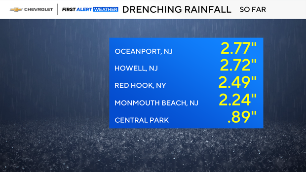
Copious amounts of rain have fallen in many locations, especially the Jersey Shore, where 2-3 inches have been reported.
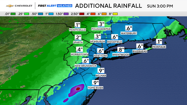
The severe threat has now come to an end, and residual rounds of rain will continue throughout the overnight hours. Some of the rain may be heavy at times, however the flash flood threat is largely diminished.
Autumn feel on Sunday
Rounds of rain will persist through Sunday morning, with some clearing late in the day. Additional rainfall totals should range between .50-1 inch.
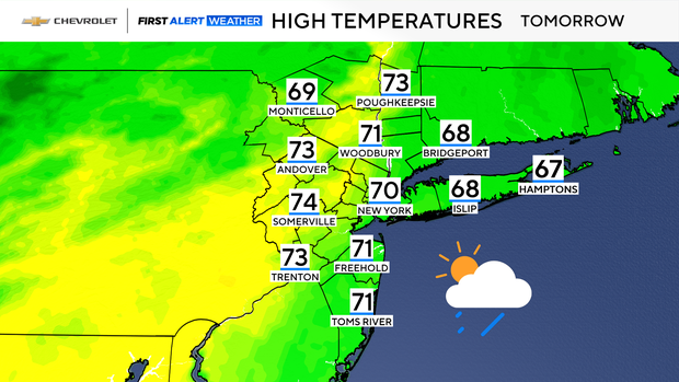
Other than the rain, Sunday will feature much cooler temperatures. Highs will feel very much like fall, topping out in the low 70s at best. That will be a huge contrast from Saturday's summery highs in the mid to upper 80s.
Once the rain clears out by Sunday afternoon, another long, dry stretch is anticipated through next week.