Winter storm underperforms in Tri-State Area. Arctic blast arrives overnight.
NEW YORK — New York, New Jersey and Connecticut were spared the higher snowfall totals that were projected for Sunday's storm.
All locations in the region did receive some measurable snowfall, but overall the storm underperformed. The highest totals were found, as expected, to the northwest, where Hopewell Junction in Dutchess County got 8 inches, followed by Chester in Orange County with 7.7 inches.
Hackettstown, New Jersey received 6.2 inches. Elsewhere across the region, 2-5 inches fell on average. Within New York City, reports were spotty, but the CBS News New York Weather Team measured 1.7 inches.
Tri-State Area officials had issued warnings and discussed the states' preparations in the days leading up to the storm.
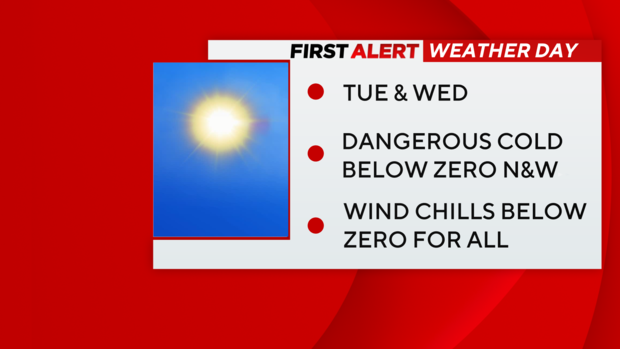
Dangerous cold in New York, New Jersey and Connecticut
Once the snowstorm officially passes during the overnight hours, brutally cold air will move into the region.
The airmass, which originated in Siberia, will lead to temperatures in the teens by Monday morning, meaning Sunday's snowfall will freeze, creating dangerous conditions on roads. Even with some sunshine in place, Monday's highs won't get past the mid 20s.
It will get even colder on Tuesday and Wednesday, which have also been designated First Alert Weather Days. Widespread low temperatures in the single digits and even some sub-zero readings are likely for each morning, with Tuesday's forecasted low in New York City expected to be 9 degrees. That would mark the first time in the single digits since February 2023.
Gusty winds will come with the bone-chilling temps, sending windchills below zero. Temperatures aren't expected to rise above freezing until Saturday. Aside from a few snow showers at times, not much additional snow is expected throughout the week.


