Chance of heavy rain, strong winds late Tuesday into Wednesday for NYC area
NEW YORK -- The weather forecast looks rainy and windy late Tuesday into Wednesday around New York City.
Tomorrow will be a First Alert Weather Day as we track heavy rain, localized flooding and strong winds.
Weather around NYC area today
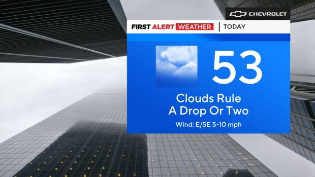
We're in the thick of the fog Tuesday morning. The bulk of the day is dry, so you can set aside the umbrellas. But don't be surprised if you encounter a little drizzle or a nuisance shower.
Our next round of rain, however, will be heavier. Not to mention, the winds will be stronger with gusts to over 50 mph east of the city.
Rain, wind, then plunging temperatures
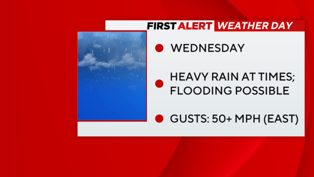
The rain will really pick up in coverage and intensity tonight, particularly overnight. Then, it becomes widespread out the door tomorrow, and it is with us all day long — and heavy at times. That said, localized flooding is certainly a possibility.
Regarding temperatures, it will be an unseasonably mild day with highs in the low 60s, if you can believe it.
Thankfully, the rain will exit by tomorrow evening. But behind all that, temperatures will absolutely crash — we're talking wind chills in the 20s!
Live radar around Tri-State Area
Stick with our First Alert Weather team for the latest forecast, live radar and weather alerts.


