CBS2 6/4 Saturday Afternoon Weather Headlines
By Matt DeLucia
CBS2 Meteorologist/Weather Producer
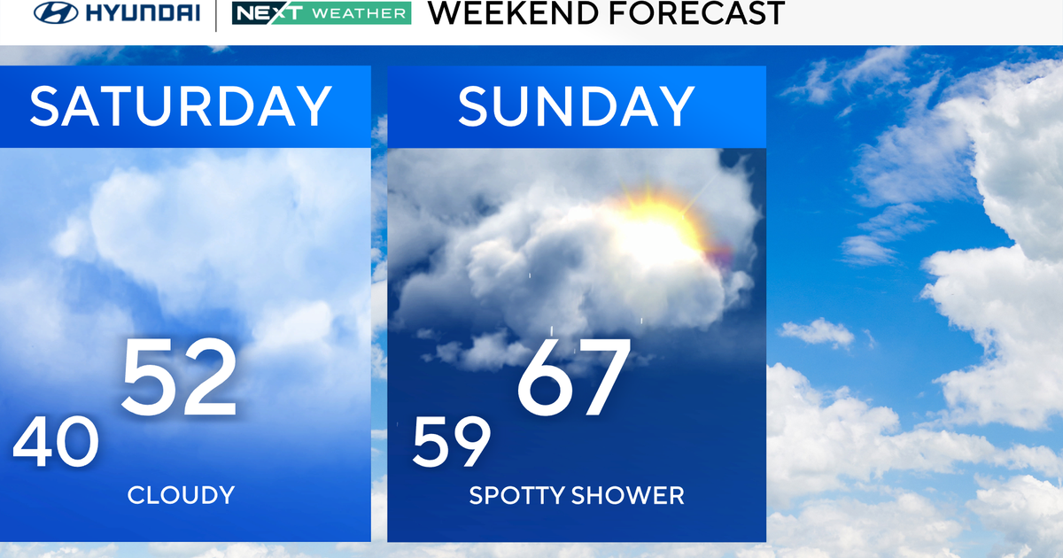
Good afternoon, everyone! It's a split weekend for the tri-State, and today is the better of the two. Expect a mix of sun and clouds with temps reaching the low 80s. You'll definitely notice the uptick in humidity though and it'll be feeling more like the upper 80s this afternoon. Can't rule out an isolated shower or t-storm today, but the better bet will come tomorrow.
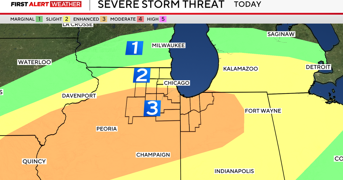
The Storm Prediction Center has placed our region under a marginal to slight risk of severe weather for Sunday. A low pressure system currently tracking through the Great Lakes will bring a warm front through Sunday morning with some scattered showers and storms. There looks like we could get a lull in the late morning and early afternoon before the cold front approaches.
Its late tomorrow afternoon and evening that a line of strong to severe storms looks to move through. The biggest threats will be strong winds, heavy downpours, and possibly some small hail. Flash flooding is possible where any heavy rain does occur.
It looks to clear out for Monday with just a slight chance of a lingering shower. Be sure to keep an eye to the sky tomorrow and stay safe if storms approach. Stay tuned to CBS2 for the latest!