Rising humidity in NYC brings back increased chance of showers, stormy weather this week
The week starts off with cloudy and dry weather for the Tri-State Area before storm and shower chances ramp up.
Rain chances stay relatively low for Monday. There could be a spotty shower at any time, but most of the day will be dry. Highs will be in the mid to upper 70s with a muggy feel.
Shower and storm chances will increase at night, especially late.
A First Alert Weather Day has been issued for Tuesday and Wednesday due to the threat of strong to severe thunderstorms.
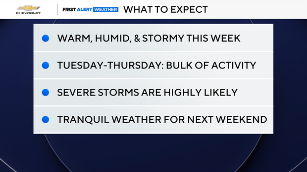
Expect scattered showers and thunderstorms Tuesday. While there may be some downpours early on, the greatest risk of severe weather and localized flooding will be in the afternoon and evening hours. Plan for storms during the evening commute.
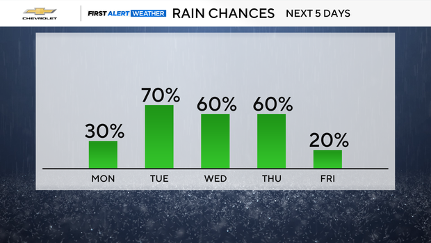
Wednesday brings more of the same, though some uncertainty remains about storm coverage. Scattered showers and storms then continue on Thursday before we dry out toward the Labor Day weekend.
All severe weather hazards are on the table, including damaging winds, flash flooding, hail and tornadoes.
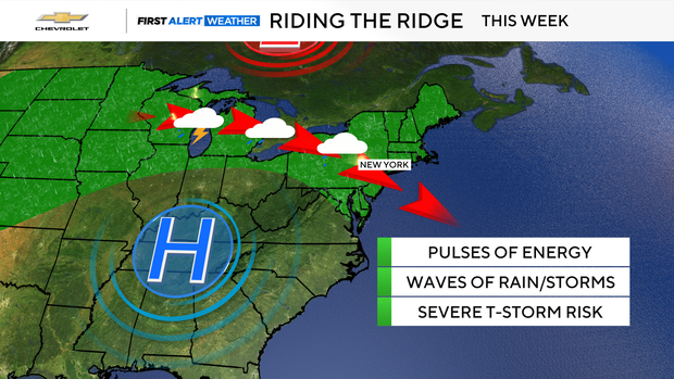
The unsettled stretch is due to a ridge to the southwest. We'll be on the northern edge, allowing rounds of showers and t-storms to rotate around high pressure, following a track from the Great Lakes southeastward into our area. The key takeaway is that it won't be raining the entire time, but expect periods of wet weather.


