Rainy weather, severe storm threat returns to NYC area. Get the First Alert Weather Day Forecast.
After a tranquil, warm weekend, more turbulent weather lies ahead in the New York City area.
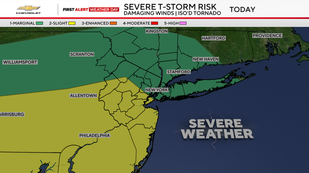
A First Alert Weather Day has been issued for Monday due to the threat of heavy rain and severe thunderstorms.
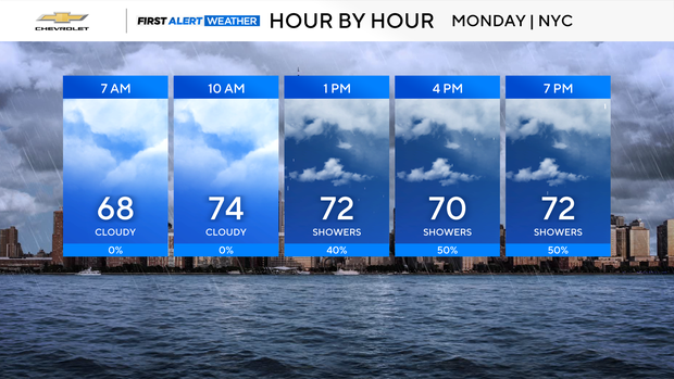
To start off Monday, lots of clouds will be in place, with on and off showers. Some isolated downpours are possible.
Confidence has increased that severe thunderstorms will develop in the afternoon and evening hours, roughly between 2-11 p.m., as a strong area of low-pressure pivots through the region.
Flood watch for NYC
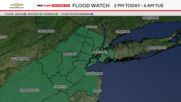
There's a flood watch from 2 p.m. Monday to 6 p.m. Tuesday for New York City and most of northern and central New Jersey. The area is expected to see between one and three inches of rain.
Initially, the greatest concern was heavy rain that could lead to flash flooding; however, the threat of damaging winds and isolated tornadoes has risen and is now a concern along with the flash flooding.
With lots of humidity and high atmospheric moisture in place, rainfall rates could reach 1-2 inches per hour at times, which is why the risk of flash flooding is elevated. While the dry conditions of late may mitigate river flooding, street and urban flooding are definitely likely.
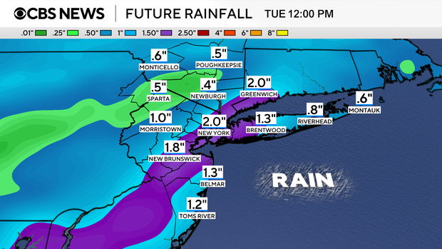
Rain lingers for soggy Tuesday morning
Severe thunderstorm activity should come to an end by Monday night, followed by residual showers that could linger into Tuesday morning. Overall, final rainfall totals through this event are expected to average between 1-2 inches. Higher totals are possible where the strongest thunderstorms develop.
Highs on Monday will be kept down due to the rain, only reaching the mid to upper 70s. The rest of the week will feature highs in the low to mid 80s, which is normal for late June. Our next rain chance returns on Thursday.


