Chilly start Monday in NYC, flurries possible in afternoon. Here's the First Alert Forecast.
You'll want to bundle up Monday in the New York City area for a chilly start to the week before wetter, milder weather arrives midweek.
The morning commute will be rather cold, with wind chills in the 20s and even the teens in some spots. So layer up!
If you're heading out early, gloves and a warm coat are a must.
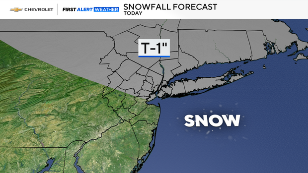
A few flurries possible
Expect a few flurries to dance through the area by lunchtime, but nothing major. It'll be just enough to remind us that winter is here.
Later this afternoon, leftover flurries linger mainly north and east of NYC. Keep an eye out if you're traveling in those directions.
Tonight brings some clouds, but it's quiet overall.
Milder days ahead
Things start to change Tuesday as showers move in during the afternoon and temperatures climb to a milder 40 degrees.
The rain continues tomorrow night. Watch for icy patches if you're well north and west of the city — travel could get tricky.
Wednesday keeps the wet theme going with morning showers, but it'll be noticeably milder.
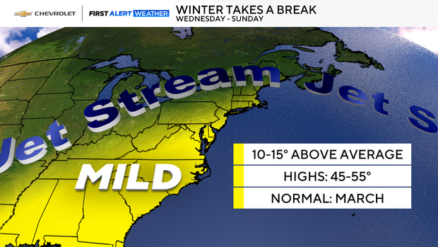
Highs reach the upper 40s, making it feel more like early spring than January.
So, while Monday is all about braving the cold, the next couple of days bring a wetter, but warmer pattern.