New Jersey gearing up for potential nor'easter as coastal storm strengthens

New Jersey is gearing up for a potential nor'easter as a coastal storm strengthens.
Winds were already cranking along the Jersey Shore on Wednesday, and the storm will mean prolonged problems along the coast.
Click here to check the latest weather watches, warnings and alerts.
New Jersey Gov. Mikie Sherrill said she's monitoring the storm.
"My team continues to monitor our first major Atlantic storm of the fall, with the greatest impacts expected along the South Jersey coast. Coastal flooding could continue through Friday, while strong winds and large waves could bring power outages, beach erosion, and dangerous surf. Please monitor local forecasts and official alerts, plan ahead in flood-prone areas, and remember to never drive through flooded roadways," Sherrill posted on social media.
PSE&G said it is prepared for the weather conditions and has positioned additional crews and resources throughout its service area to respond to outages.
"We're closely monitoring the evolving forecast and potential impacts across the areas we serve," Paul Toscarelli of PSE&G said. "Our focus throughout the storm will be on responding safely, restoring customers as quickly as conditions allow and keeping them informed along the way."
The utility is urging customers to charge phones and other essential devices, keep flashlights and fresh batteries handy and to secure or bring outdoor furniture inside.
Problematic conditions will persist for days and may get worse later in the week as the coastal storm forms, strengthens and moves closer to shore.
Nonstop wave action will erode the coastline this week. Another concern is water being pushed onto land. A Coastal Flood Warning went into effect for Ocean County at 4 p.m. Wednesday, and will remain in effect through Friday night. During every high tide cycle, minor to moderate coastal flooding should be expected.
William Rumbolo, superintendent of public works in Seaside Heights, says the borough is being proactive. All garbage cans have been taken off the beach.
"All of our beach storage is off. Our lifeguard benches are all secured and off the beach, and we're out cleaning storm sewers so that if we do get tidal flooding, the water has someplace to go," Rumbolo said.
That's especially important for Back Bay communities, where the worst coastal flooding is expected this week as northeast winds continue to howl. Wednesday, winds gusting to 40 mph drove breakers 6-12 feet.
Those winds drove whitecaps on the bay, ruffled feathers, shook umbrellas and sent hats flying.
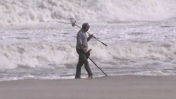
"They're looking kind of crazy," Elizabeth resident Miquel Torres said.
"Take everything in. Anything that will fly away's gotta be nailed down," Doug Walker of Seaside Park said. "It's brutal. All last week the ocean was just flat perfect out there, and now it's just amazingly strong."
In Seaside Heights, Nadeen Hodge took a look as the surf pounded the shore.
"It is so beautiful to look at and hear. It's just amazing. It's powerful," Hodge said.
Waves out in the open Atlantic are expected to swell as high as 25 feet this week.


