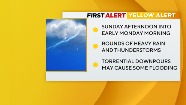
First Alert Weather: Yellow Alert in effect Sunday afternoon for storms, possible flooding
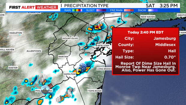
Another hot and steamy weekend is upon us. This has sparked the development of scattered showers and storms across the area today. Two of the storms reached severe criteria, including one in Middlesex County that produced some hail and strong winds.
For Saturday night, the storm chance diminishes, and we are left with mostly cloudy skies. It will be warm and muggy, with a low of 74.
Sunday will begin dry. Then by the afternoon, the threat of showers and storms returns in earnest.
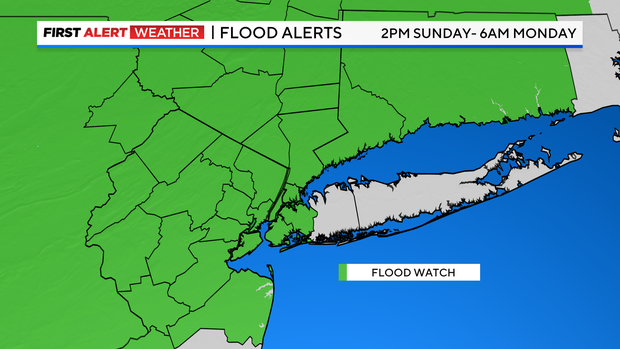
Unlike Saturday, the coverage of the showers and storms will be more widespread. Because of this, the National Weather Service has placed most of our area into a Flood Watch, and therefore, our weather team has issued a Yellow Alert. With excessive amounts of atmospheric moisture available, any storms that develop will be capable of producing copious amounts of rain. Their slow-moving nature will only add to that.
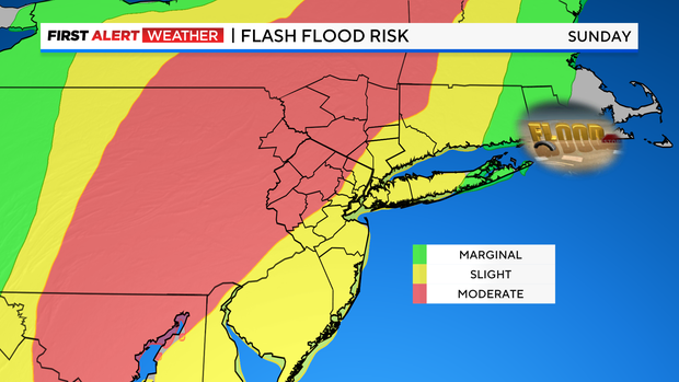
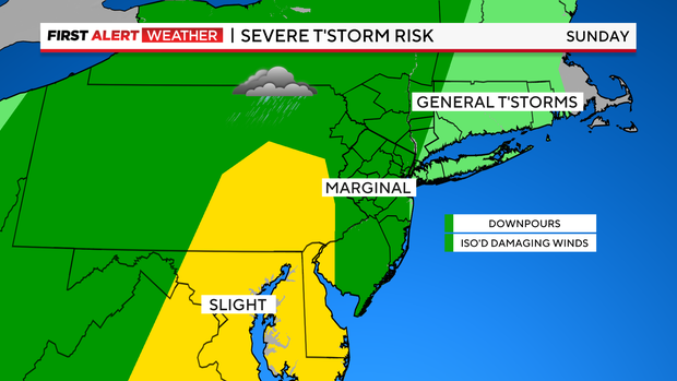
The highest rainfall totals and greatest chance of flooding looks to occur west of the city, and some locations may receive several inches of rain. Severe thunderstorms are not highly likely; however, the chance exists.
Steam bath conditions will continue, as we see a high of 82.