First Alert Forecast: Classic summer day, upper 80s and mostly sunny
Happy Sunday! It's time to rinse and repeat ... but more like sweat and repeat.
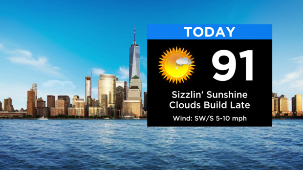
It'll be another classic summer day around the area with highs in the upper 80s and low 90s. Expect mostly sunny skies with some more high clouds streaming in toward evening.
It's humid, but luckily not overly oppressive with dew points staying in the 60s.
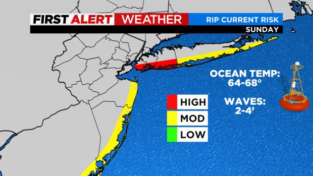
You can find some relief from the heat at the beaches with temps closer to 80. Use caution if hitting the water since we have a high rip current risk for the city and Nassau County beaches today, with a moderate risk elsewhere.
Clouds increase overnight with some showers arriving after midnight, primary to the north and west.
Monday will feature showers with embedded downpours moving through during the day. It won't be a washout but expect a period of three to six hours of wet weather at some point from west to east.
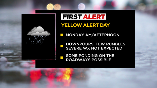
No severe weather is expected, but we've issued a Yellow Alert due to brief downpours possibly causing minor flooding.
It'll be cooler tomorrow, but still very humid. Highs will be in the upper 70s and low 80s. Any leftover wet weather moves off the coast in the early evening, giving way to a much more comfortable airmass for Tuesday.
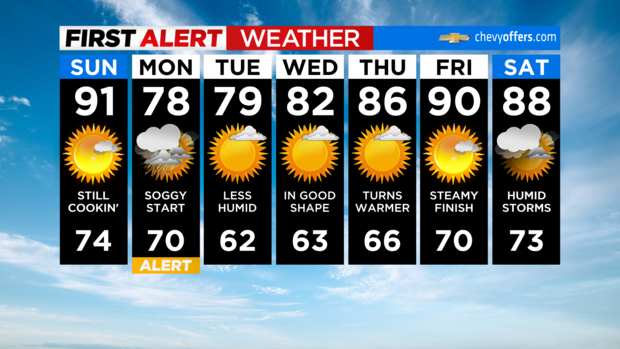
In fact, after Monday, the rest of the week looks nice and quiet with a gradual warming trend.
Stay cool!


