CBS2 Weather Headlines: Another Summer-Like Day, Severe Weather Risk Saturday Afternoon
By Matt DeLucia, CBS2 Meteorologist/Weather Producer
We're looking at another summer-like day across the area with highs once again in the mid to upper 70s, with even a few 80s for inland New Jersey. It's a mix of sun and clouds into early afternoon, but keep an eye to the sky... big changes are incoming!
As a strong cold front gets closer, a line of showers and thunderstorms will approach our western counties by 2-3 p.m. This will progress eastward through the region, likely reaching the city around 5-6 p.m. and clearing the east end shortly after midnight.
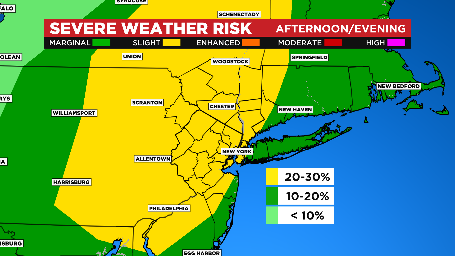
While any storms look to weaken as they approach the coast, we do have a slight risk of severe weather, especially north and west of NYC. Gusty winds and brief heavy rain are the main threats, but an isolated tornado cannot be ruled out. Just stay weather aware!
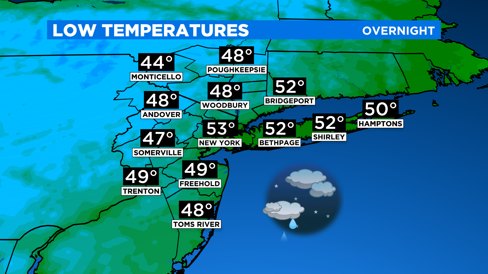
Things will gradually clear out overnight and temps fall drastically behind the front. Brisk NW winds kick in and by Sunday morning, we'll be waking up to temps in the 40s and low 50s!
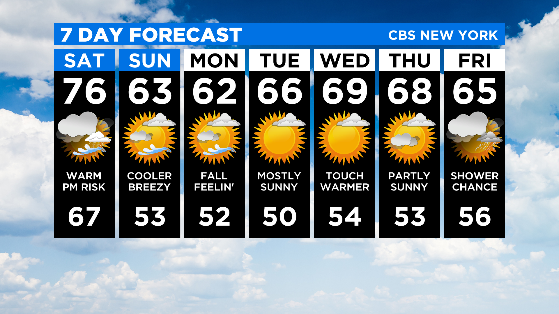
Highs tomorrow will be about 15 to 20 degrees cooler than today, topping out in the low 60s. It's looking good tomorrow, but a brief passing shower or sprinkle is possible.
The fall temps stick around into next week with several nice days to look forward to.


