12/25 CBS2 Christmas Evening Weather Headlines
By Matt DeLucia
CBS2 Meteorologist/Weather Producer
Good evening, folks! Hope you're having a fantastic Christmas... or should I say spring-like Christmas! We broke the previous record of 64 just after midnight in Central Park, putting our high at 66 for today. It's officially been the warmest Christmas Eve and Christmas Day on record.
A pesky stationary boundary will be keeping our weather unsettled, with some showers moving through tonight, mainly south of the city. We've even had a few rumbles of thunder down in Ocean County! Expect cloudy skies overnight with the shower chance continuing.
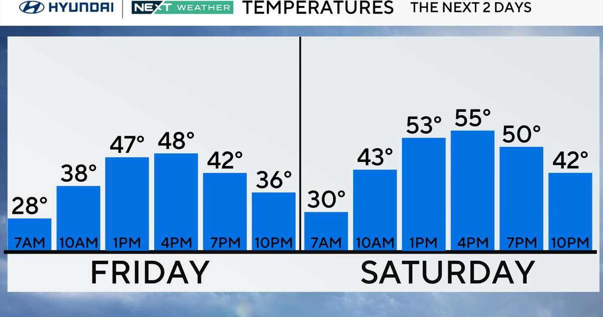
Tomorrow will be cooler, but still more than 10 degrees above normal in NYC. Expect a high around 52 with a lot of clouds, some peeks of sun, and late showers. Then on Sunday, we're back into record territory! Highs top out in the low to mid 60s, with once again a shower chance around.
Monday brings a reality check. After a cold front moves through early, highs will struggle to get out of the 30s for some. The city will make it into the low 40s under partly-sunny skies. As for wintry weather-- definitely a possibility late Monday into early Tuesday for our N&W suburbs before changing to rain, so we'll watch that for you.
Check back in soon for the latest.
Merry Christmas!