12/21 CBS2 Thursday Afternoon Weather Headlines
By Mark McIntyre, CBS2 Meteorologist/Weather Producer
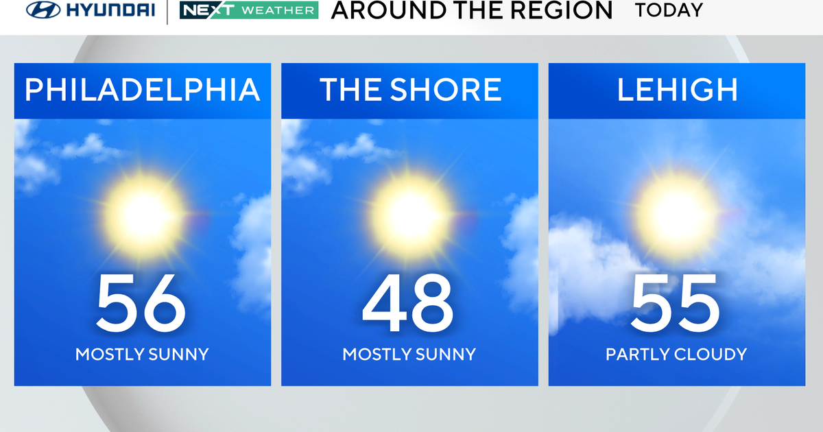
BRRR! It's a cold day across the area...appropriate since today marks the arrival of winter! Temps will only top off in the mid & upper 30s for most locations.

Clouds thicken later tonight ahead of a storm system that will bring a complicated mess to the area tomorrow & Saturday. First, there will be some light wintry precipitation for the farthest northern 'burbs. Perhaps 2" of snow in the highest spots, otherwise a coating of snow but with some sleet & freezing rain...so some slippery roadways are likely. For the rest of the area, it'll be milder with some drizzle & showers especially late, as we reach a high in the upper 40s.

Our best shot of a good soaking is overnight into Saturday morning, and it'll be just rain with temps in the 50s. Things dry out Saturday night and temps drop all the way back into the low/mid 40s for Sunday under mainly clear skies...but another round of wintry weather is likely Sunday night into early Christmas morning. Who will have a White Christmas? Stay tuned for the latest thinking!