Do Chinese satellite images show missing plane debris?
They may be clues to the disappearance of Malaysia Airlines Flight 370 - or they may be nothing.
A Chinese government website early Thursday released satellite photos of what it calls three suspicious objects floating off the southern tip of Vietnam east of Malaysia. They are in the region where the plane disappeared Saturday with 239 people on board.
China's civil aviation chief stressed Thursday that there is no proof the objects are connected to the missing jetliner.
However, the location of this suspected debris is in an area fairly close to the intended flight path of the missing plane, which disappeared while en route from the Malaysian capital, Kuala Lumpur, to Beijing.
China's official news agency said the images captured March 9, the day after the Boeing 777 vanished, appear to show three fairly large floating objects. The largest one is estimated to be 79 feet long and 72 feet wide.

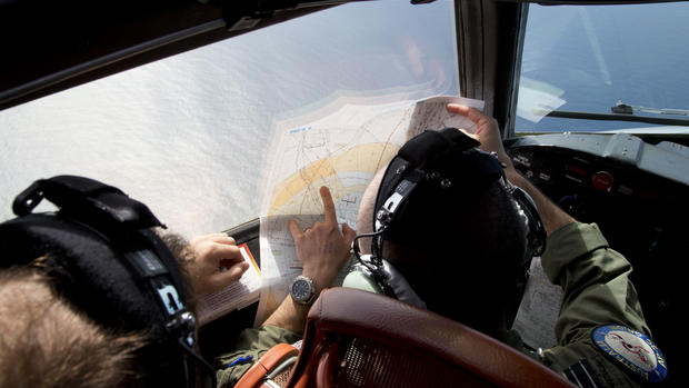
Meanwhile, it's up to search teams on the scene to determine whether these images are actually parts from the missing aircraft.
With every hour that goes by, any debris that is spotted is likely to be far from the plane's crash site, making the investigation even more difficult.
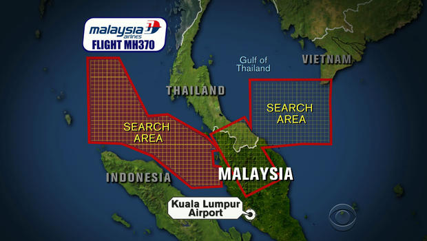
The search area has expanded to include 180,000 square miles on both sides of the Malay Peninsula.
It is still unclear which way the aircraft was heading when it vanished. Malaysia's air force chief said a radar signal was picked up over the Malacca Strait, hundreds of miles from the last contact with the missing jetliner. But it has not been confirmed that this was Flight 370.
"There is a possibility this aircraft made a turn back but we are not sure whether it is the same aircraft," air force head Rodzali Daud told reporters.
One of the focal points of the search is the Strait of Malacca, one of the busiest shipping channels in the world.
The strait runs the entire way down the west side of Malaysia. It is on the opposite side of the country from where the search started out and 350 miles from where the plane lost contact with air traffic control, which gives a sense of how vast the search area has now become.

A New Zealand oil right worker sent an email saying he'd seen a plane breaking up off the southeastern coast of Vietnam. The Vietnamese navy is now searching that area.
India sent ships to help the search today. In all, a dozen countries, including the United States, are combing the waters for clues.
On Wednesday, Malaysian government officials told passengers' relatives that the last words of the captain to air traffic control indicated nothing was wrong. But with no confirmed trace of the jet, the words did nothing to calm waiting friends and families.
With every day that goes by, Malaysian authorities are coming under increased pressure to show that the investigation is on the right track.
