First large winter storm of the season continues Thursday morning in Southeast Michigan


(CBS DETROIT) — The first major winter storm of the season is bringing significant accumulations to Southeast Michigan.
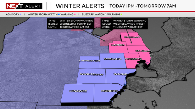
Snow began Wednesday afternoon and will linger into Thursday morning. From 1 p.m. Wednesday to 7 a.m. Thursday, a Winter Storm Warning will go into effect for Macomb, Sanilac, and St. Clair counties, while Oakland, Lapeer, Livingston, Monroe, Lenawee, Washtenaw, and Wayne counties will be under a Winter Weather Advisory.
It all moves in from the Southwest with mainly snow for Michigan and a wintry mix possible close to the Michigan/Ohio border and Lake Erie shoreline.
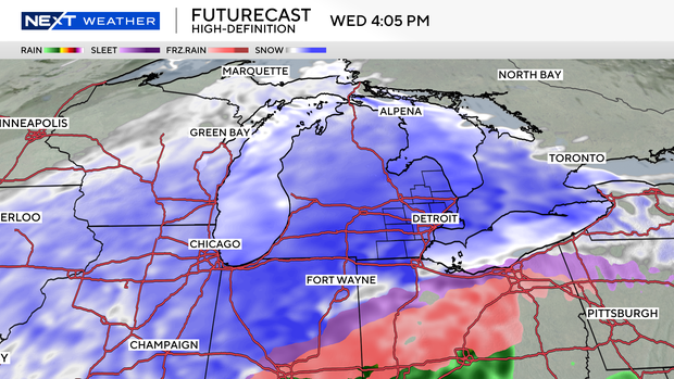
The timing for light snow first moves into western counties by 1 p.m. Wednesday. Heavier snow moved into most of Southeast Michigan by 6 p.m.
Models have not been in good agreement when it comes to snow totals.
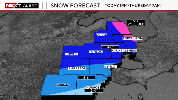
We could see up to 10 inches of snow in northern zones like Sanilac County, with high-end snow totals between five and eight inches in central zones. Southern zones will see a little less, between four and six inches of snowfall. There is a chance for minimal ice accumulation along Lake Erie and in the southernmost portions of our viewing areas before it all moves out Thursday morning.
Wednesday and Thursday morning will be a NEXT Weather Alert Day, as the heaviest snow moves in.
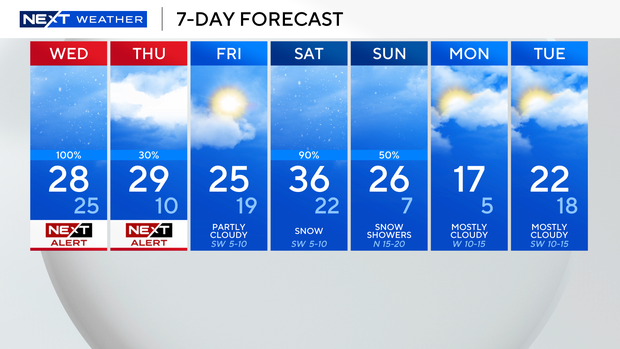
Temperatures will not go above freezing for most of the week. Any snow that falls will have a hard time melting.
You can get your latest Next Weather forecast on air, online or on CBS News Detroit and Pluto TV.