Strong storms possible in Southeast Michigan early Monday followed by gusty winds

If it feels like the wind just won't quit lately, you aren't wrong.
Hold onto your hats and your trash cans because Metro Detroit is in for another rough stretch of weather over the next 36 hours.
A potent low-pressure system is sweeping through the Great Lakes, bringing drastic weather changes to Southeast Michigan.
The CBS News Detroit NEXT Weather Team is tracking two primary threats: strong winds sticking around through Monday and a window for strong to severe thunderstorms late Sunday night into early Monday.
Here is everything you need to know to stay prepared.
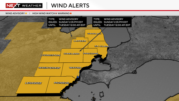
A wind advisory is in effect for all of Southeast Michigan until midnight on Monday night:
- Sustained Winds: 20 to 30 mph out of the south/southwest.
- Peak Gusts: 45 to 50 mph.
- Impacts: Expect difficult driving conditions for high-profile vehicles, a few power outages and the potential for downed tree limbs, especially given the recent high wind events the region has already experienced.
While Sunday's unseasonably warm high in the low 70s might have felt nice, the warmth is helping fuel an unstable environment ahead of an approaching cold front.
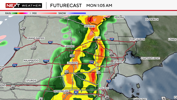
As we head into the overnight hours, a line of showers and thunderstorms is expected to cross the Lower Peninsula of Michigan.
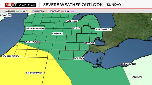
The National Weather Service has placed all of Southeast Michigan under a marginal risk for severe weather.
The main window for storms opens late Sunday night.
The main, and nearly only, threat is straight-line wind gusts in excess of 60 mph.
Make sure your phones are charged and your weather alerts are turned on before you go to sleep Sunday night.
If you step out the door Monday morning, don't let the lingering 40-degree temperatures fool you. As the cold front fully pushes through, our weather will take a harsh, winter-like turn.
Gusts of 40 to 50 mph will persist throughout the day on Monday. We will drop from the upper 40s down into the 30s and even 20s by the late afternoon and early evening hours.
Rain showers early Monday will transition into a chance for snow showers through Monday evening.
By Tuesday morning, St. Patrick's Day, you'll be waking up to wind chills in the single digits. Make sure you have your heaviest winter coats on standby.