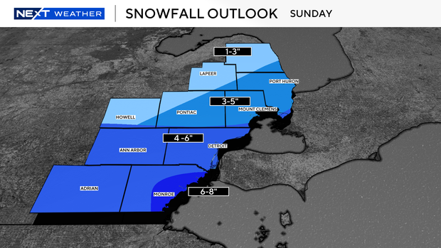
Projected snowfall totals for Sunday winter storm in Southeast Michigan
Winter is fully upon us with dangerously cold temperatures and round after round of snowfall.
The next round will come at the end of the weekend as a major storm system will move across the middle and eastern portion of the country.
A winter storm warning will be in effect on Sunday from 5 a.m. to midnight in Monroe County, according to the National Weather Service.
Livingston, Macomb, Oakland and St. Clair counties will be under a winter weather advisory from 9 a.m. until midnight on Sunday. A similar alert will be in effect for Lenawee, Washtenaw and Wayne counties the same day from 5 a.m. to midnight.
In Southeast Michigan, we will begin seeing snowfall late Saturday night. We won't see much accumulation Saturday night, as we will on Sunday; that's when we'll see the brunt of the system reach us.
The heaviest snowfall will move in mid-day and continue until after dinner. We'll begin to see the system moving out with dry conditions around midnight. Monday morning's commute could be a very dicey one.
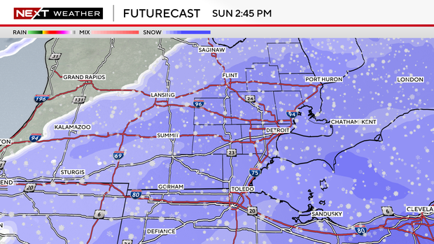
Now that we know the timing, the amount of snow we'll receive is the next question. The gradient is tight. We have a big range of potential snow totals across our viewing area. Generally speaking, the further north and west will have the least snow accumulations. The further south and east, the more snow will accumulate.
One to three inches of snowfall totals for the northern half of Sanilac County, cutting diagonally across Lapeer County. Three to five inches of snow in areas around Pontiac, Mount Clemens and Port Huron. Four to six inches of snow in parts south of Michigan Highway 59. A section of Monroe County could see up to eight inches of accumulation.
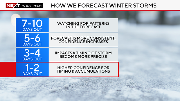
Your CBS News Detroit NEXT Weather Team will continue to closely monitor this system. The NEXT Weather team will continue to tweak timing and accumulations as the storm moves closer to give you the most accurate forecast possible.
Stay with the CBS News Detroit NEXT Weather team for updates on Sunday's winter storm.