Live Winter Storm Tracker: Wet Snow Continues Through The Afternoon Commute
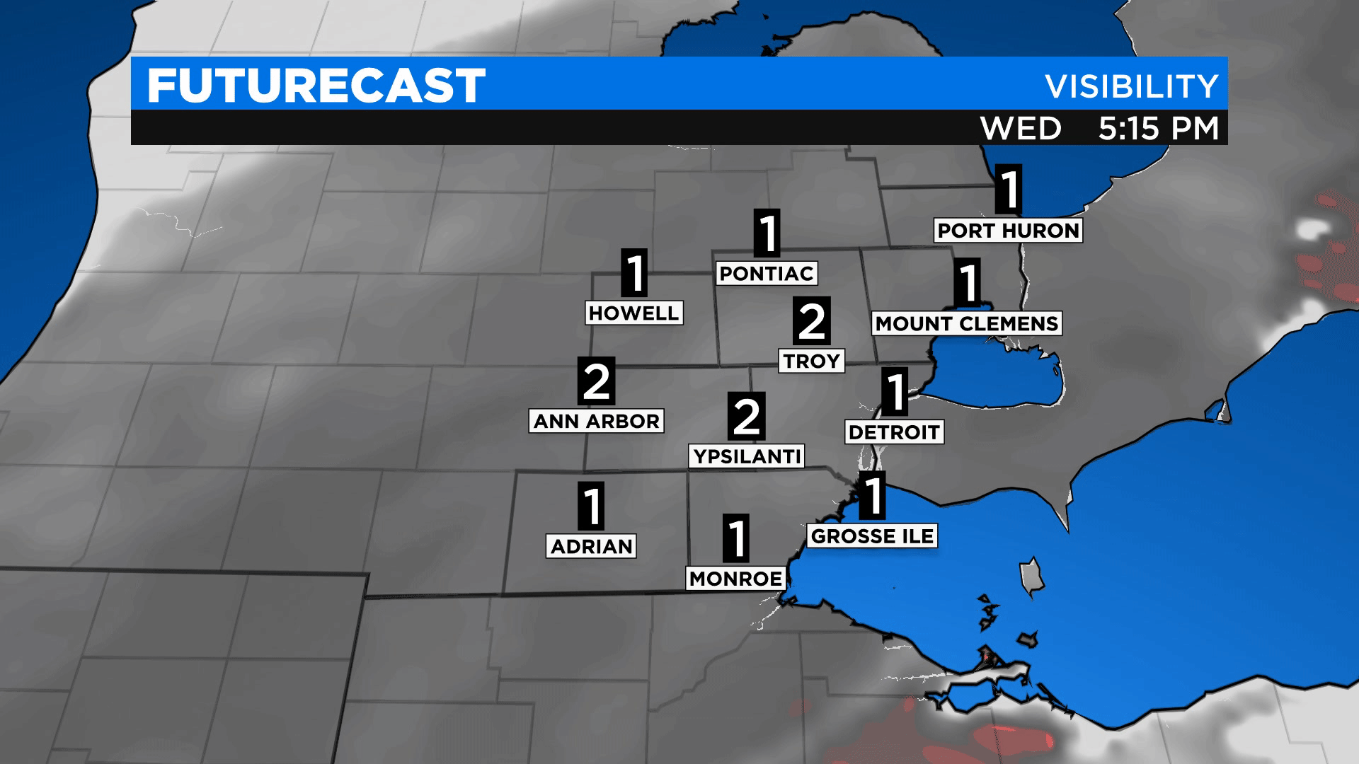
4:48 pm - As fog and snow continue in metro Detroit, visibility is low. Expect one mile of visibility at best. However, as the snow pushes east overnight, visibility will increase to some of our northern and western counties, especially. - Chief Meteorologist Karen Carter
3:38 pm - Widespread snow sticks around through most of the evening commute. Temperatures fall with it allowing for icy conditions. Be safe traveling. - Kylee Miller
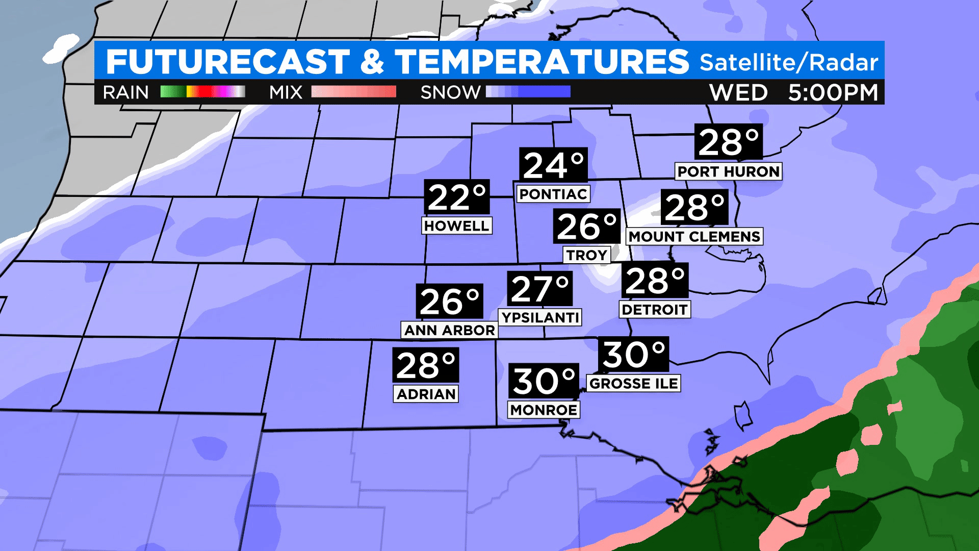
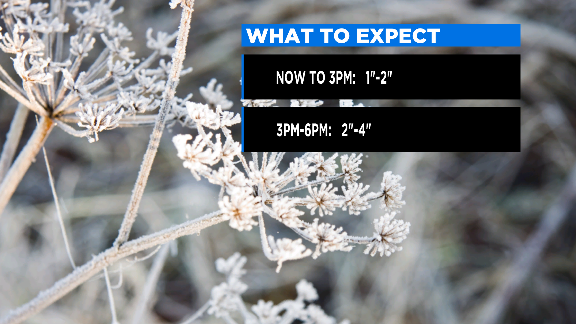
2:53 pm - Snow is steadily increasing across the area. We can expect heavier snowfall with rates up to one inch per hour this afternoon. We should pick up another one to two inches by 3 p.m. and up to another four inches by the end of the evening commute. -Chief Meteorologist Karen Carter
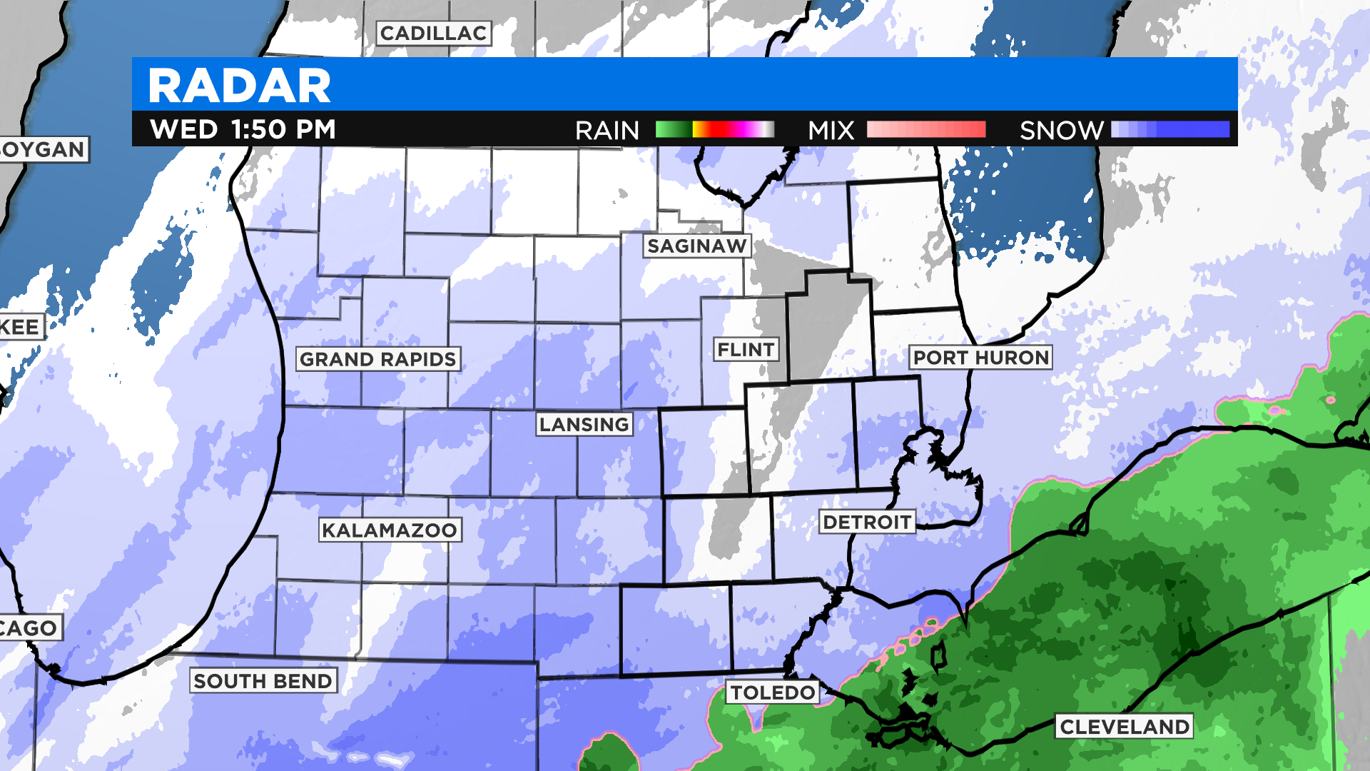
1:50 pm - We are tracking heavy bursts of snow right now from Mid-Michigan to the Michigan Ohio state line. Metro Detroit, it's still moderate dense snow as temperatures are just below freezing. Expect heavier snow to push in by 3 PM across SE Michigan. - Kylee
10:31 am - Everything seems to be on track, WINTER STORM WARNINGS are in effect through Thursday. The rain switched over to snow, but roads are icy and a little snow-covered. Generally, 8" to 12" is expected across the area, with most of that expected to come today.
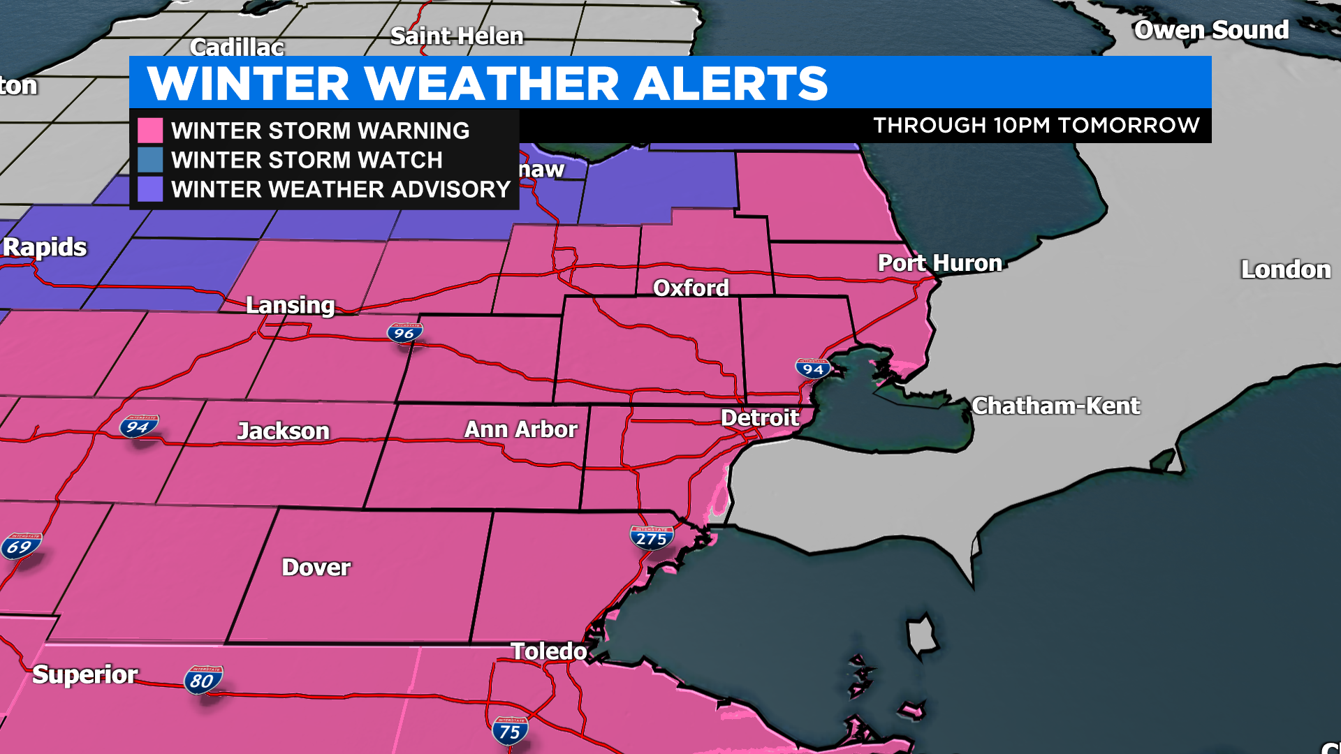
Today expect snowfall totals to shape up around 8" to 10" across central SE Michigan. 6" to 8" expected near the lakeshore due to temperatures being a little milder this morning.
Tomorrow an additional 2" to 4" could fall and favor areas South of the city.
We could see a top 5 snowstorm or very close to that, of course, we will keep you updated.
Stay safe everyone today and send over your weather photos to us. - Kylee
7:33 am - Everything seems to be on track, WINTER STORM WARNINGS are in effect through Thursday. The rain switched over to snow, but roads are icy and a little snow-covered. Generally, 8" to 12" is expected across the area, with most of that expected to come today.