Strong storm increasing Denver fire danger and bringing heavy snow to Colorado mountains

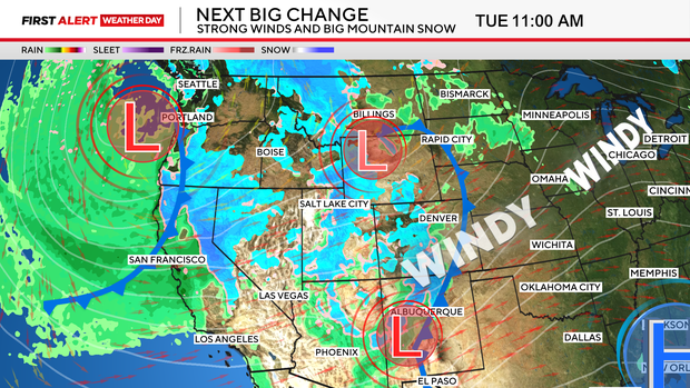
Colorado will be blasted with the threat of fire and ice this week as a major Winter storm takes aim on the Rockies. We have launched a First Alert Weather Day for both Monday and Tuesday for elevated fire danger across the eastern plains including the Denver metro area. At the same time, strong winds and heavy snow will start to slam the mountains as early as Monday night.
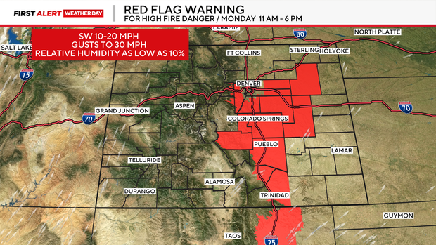
Let's start with the threat of fire danger. Strong winds will be pushing in ahead of the next big storm system. Monday many areas across eastern Colorado will see wind gusts as high as 30 mph. That combined with unseasonably warm temperatures and relative humidity levels as low as 10 percent will create perfect conditions for any spark to take off. A Red Flag Warning is in place 11am to 6pm on Monday for areas in and near the foothills and parts of the eastern plains. The downtown Denver area is not included but, areas like Evergreen, Conifer , Bailey, Castle Pines, Castle Rock, Elizabeth and Deer Trail are in the Red zone.
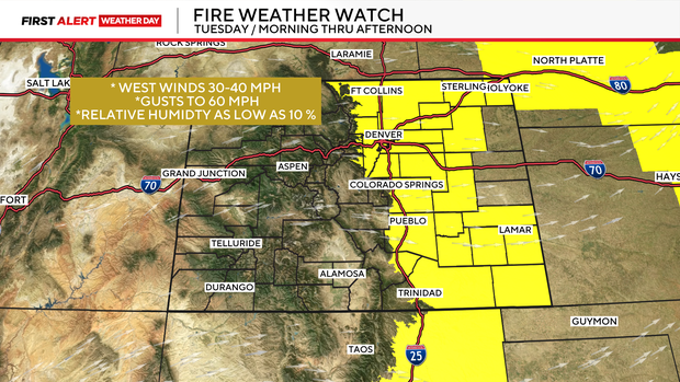
Tuesday will be worse in the wind department. Some gusts may reach 50 to 60 mph across all of eastern Colorado. There is a Fire Weather Watch posted for Tuesday including the Northern Front Range foothills, the Denver metro area and all of the eastern plains.
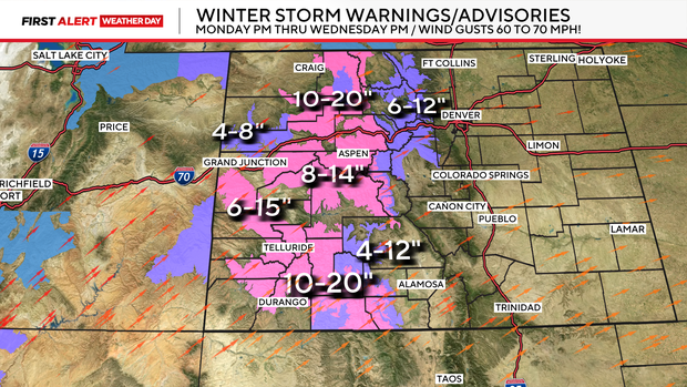
In the mountains, the story this week is the heavy snow and wind. There is are several Winter Storm Warnings and Winter Weather Advisories in place from Monday night through Wednesday night. Some areas may see a foot or more of snow during the period along with with gusts anywhere from 60 to 75 mph !
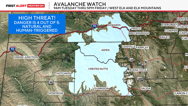
The strong winds and heavy snow may create weak slabs of snow across the west Elk and the Elk mountains in central Colorado. This will make that area ripe for the threat of avalanches. There is an Avalanche Watch starting on Tuesday morning thru the end of the week in those areas.