Quick-hitting Colorado snowstorm could bring big, fat flakes and fast accumulation to Denver Sunday night

A fast-moving storm will bring a chance for snow across Denver and the Front Range late Sunday night into early Monday morning.
While this system will not carry much moisture, it features a favorable setup for brief but efficient snowfall. An easterly upslope flow will develop as the storm moves through, helping to lift moisture against the Front Range. At the same time, a deep dendritic growth zone will allow snowflakes to grow larger than what is typically seen in many winter storms.
Large, fluffy flakes can accumulate quickly in a short period of time, leading to sharp differences in snowfall over small distances. One neighborhood may see only a trace of snow, while another just a mile away could pick up close to 2 inches.
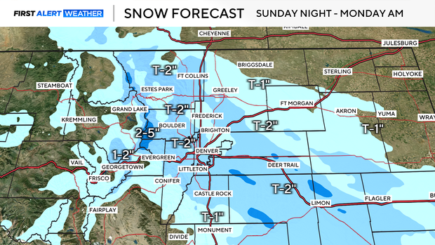
Snow is expected to begin around 11 p.m. Sunday and continue into the overnight hours. The snow will gradually come to an end from northwest to southeast by about 7 a.m. Monday. While widespread impacts are not expected, localized slick spots could develop on untreated roads during the Monday morning commute.
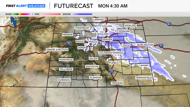
A few lingering flurries may persist into the morning hours on Martin Luther King Jr. Day, especially in and around downtown Denver, before conditions gradually improve.