Powerful Colorado storm quickly changes rain to snow

Our moisture packed storm system pushed in much colder air and a stronger upslope than was originally forecast. As a result, the drenching rain quickly changed to snow over many areas of the Denver metro and Front Range. Snow amounts below 6,000 feet will be very small and mostly on grassy surfaces. It is a different story in foothill locations on up into the Front Range Mountains where road conditions quickly turned icy and slushy in many locations.
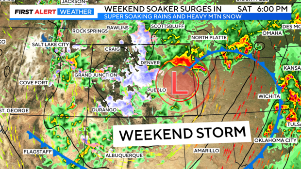
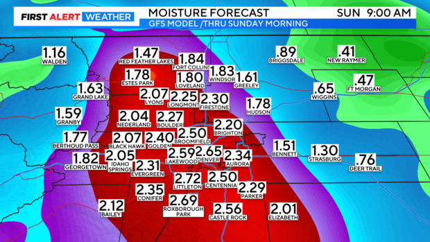
Everything from wet snow to a rain/snow mix will soak the Denver metro area and I-25 Urban corridor all day Saturday into Sunday. By the time we get to the end of the weekend some areas may see as much as 1 to 3 inches of moisture from rain and melted snow.
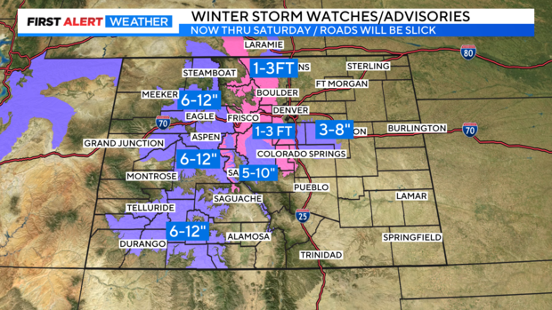
Castle Pines, Castle Rock over to Franktown and down to the north side of Colorado Springs are now in a Winter Weather Advisory for 3 to 8 inches of snow thru Saturday night. Most of the accumulation will be on grassy areas but, roads could be icy and somewhat slushy by the end of the day.
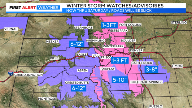
In the higher elevations the weekend story will be the the snow! We have a Winter Storm Warning for the Front Range mountains and higher foothills including the Sawatch Range and the Pikes Peak/Teller County areas thru Saturday. Some areas could see 1 to 3 feet of snow! Park county, The Western Slope and San Juan mountains could see 6 to 12 inches of snow.
Rain and snow will continue thru Sunday morning before storm releases its grip on Colorado. With warmer drier weather moving in for Monday and Tuesday.