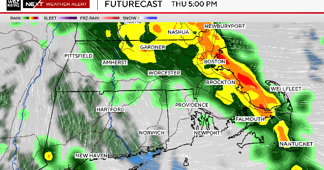
First Alert Weather Day: Expect rain throughout the night
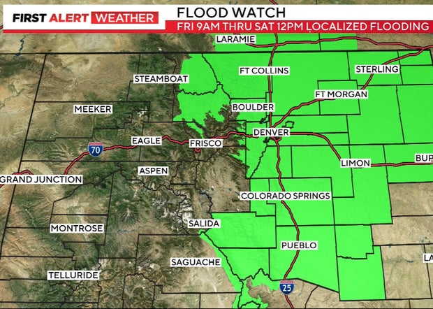
A flood watch goes into effect on Friday for nearly all of Colorado's Front Range on Friday including the Denver metro area. Slow moving storms will move in in the early afternoon on this First Alert Weather Day.
The heavy rain will continue throughout the evening, overnight and into early Saturday morning.
"Tropical moisture -- leftovers of what was Tropical Storm Harold in the Gulf of Mexico -- has drifted all the way over the state of Colorado, combining with a cold front," said First Alert Meteorologist Kerrin Jeromin. "And when you get those two overhead it's going to squeeze out every last bit of moisture in the atmosphere and bring at least the chance for flooding."
The Flood Watch continues through noon on Saturday for the entire Front Range, a portion of the Eastern Plains and the mountain corridor. The Cameron Peak burn area is most at risk for flooding.
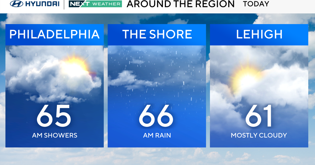
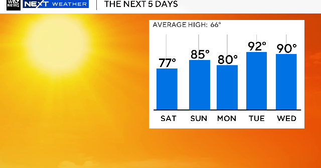
Temperatures in the Denver metro area will be in the low 70s on Friday, which is well below normal. Denver actually hit its high temperature early Friday morning and the cool, fall-like temps will stick around until Saturday.
The thermometer will hover in the low to mid-70s on Saturday with some lingering showers in the morning hours. There will be some scattered afternoon thunderstorms, too. Sunday will be warmer, with temps in the low 80s.