Fire danger today, thunderstorm chances build later this week across Colorado

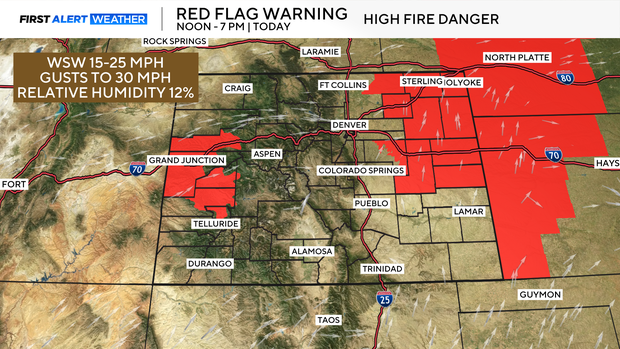
A shift in the weather pattern is bringing warmer temperatures across Colorado this week. Today's main weather concern is the heightened fire danger on the eastern plains and western slope. A Red Flag Warning is in effect this afternoon into the early evening due to low humidity and breezy conditions. Fire growth could be rapid if a fire were to occur, so outdoor burning or activities that could spark flames are strongly discouraged.
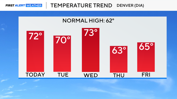
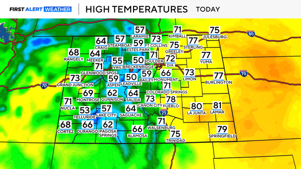
Temperatures across the plains will climb into the low 70s, sitting comfortably above seasonal averages.
Moisture will be limited, with scattered showers expected in the mountains this afternoon, with a slight chance of precipitation on the northern plains. A few isolated thunderstorms could pop up over the mountains, although any storms are expected to be brief and relatively weak. The weather remains warm and mostly dry on Tuesday, the winds are expected to ease up. A few high-based showers or thunderstorms could develop, especially over the mountains. By Wednesday, the pattern starts to shift with stronger afternoon thunderstorms possible, especially for northeast Colorado.
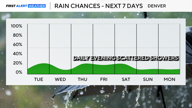
An unsettled pattern continues into Thursday and the weekend, as a weak shortwaves ripple through the region. Temperatures are expected to remain above normal through the end of the week.