Colorado Weather: Typical June Weekend Ahead, Few Severe Storms Possible On The Plains
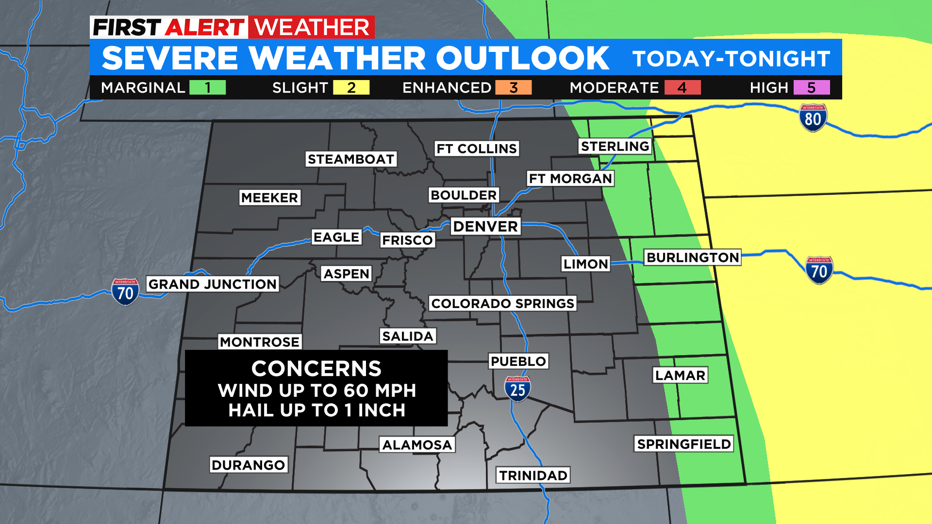
DENVER (CBS4) - Get ready for a pretty typical weekend around Colorado with quiet, comfortable mornings and warm, breezy afternoons. With daytime heating we'll see a few showers and thunderstorms pop up along the foothills and out on the eastern plains. There is about a 10% chance to see one pass through the Denver area.
Most of the storms that pop up today will be short-lived, producing more wind than anything else. But on the far plains we have a little bit more moisture in place to help feed these storms, so watch out for locally heavy rain and hail. A few storms near the Kansas and Nebraska state lines could briefly turn severe.
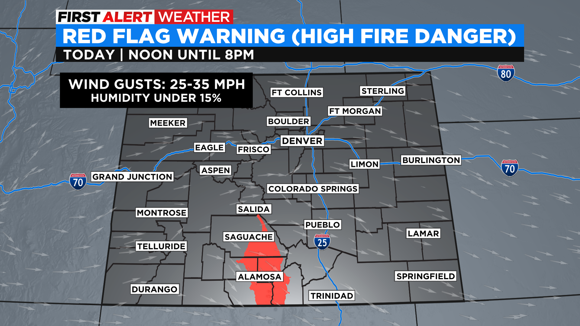
In south-central Colorado we'll see conditions Saturday afternoon reach the criteria to trigger a Red Flag Warning. It will be in effect until 8 p.m. across the San Luis Valley. Winds there could gust between 25-35 mph at times. The rest of the state should only have gusts in the 15-25 mph range except for near any thunderstorms that may pop up.
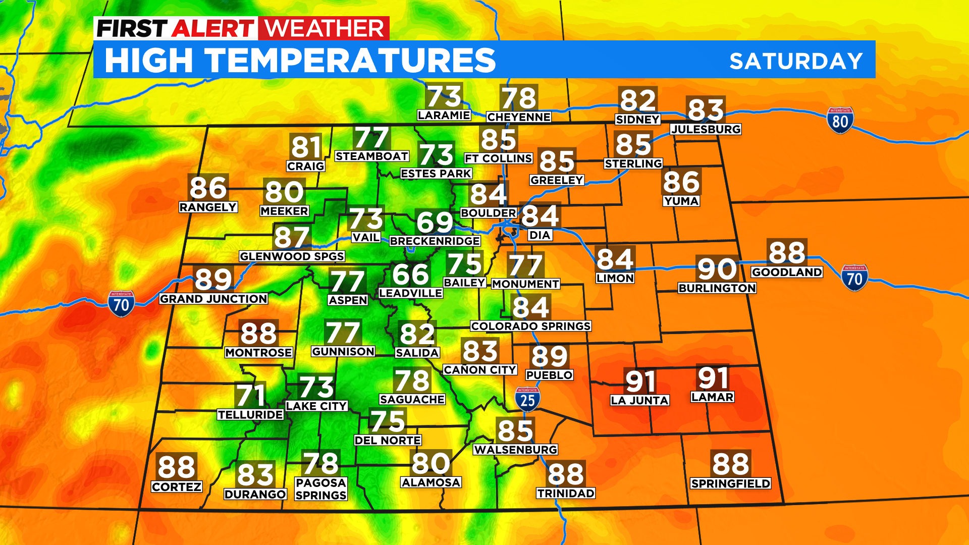
Afternoon highs on Saturday will top out in the 80s and lower 90s across all of the lower elevations, both east and west, with mostly 70s in the mountains. We'll see 60s for mountain towns above 9,500 feet with 40s and 50s above the tree line.
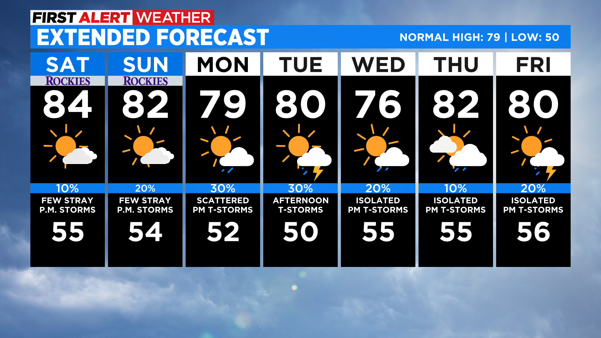
Looking at the week ahead Sunday will be a lot like Saturday in terms of temperature and weather conditions. We'll see temperatures fluctuate a little in Denver and on the eastern plains between Monday and Friday with daily chances for thunderstorms.
Starting next weekend some of the longer range computer forecast models show a large ridge of high pressure taking over the weather pattern for the central Rockies. If that happens we could enter a mid-June heat wave for several days. Stay tuned to see how that unfolds!