Colorado Weather: Mountain snow and cool mix in Denver Metro

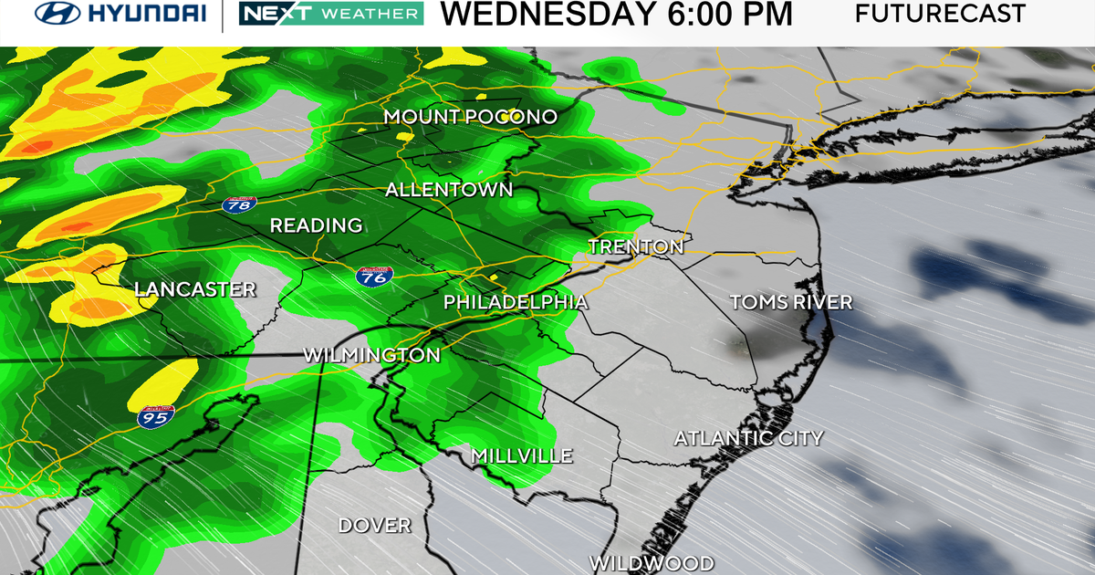
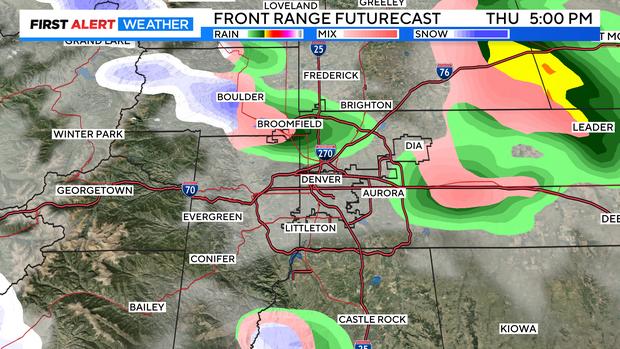
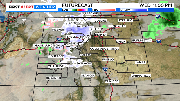
We are watching a weak cold front and a Pacific disturbance mixing together overnight Wednesday into Thursday morning. This will be bring in a shot of mountain snow and a brief cool mix of rain/snow over the Denver metro area for the Thursday morning commute.
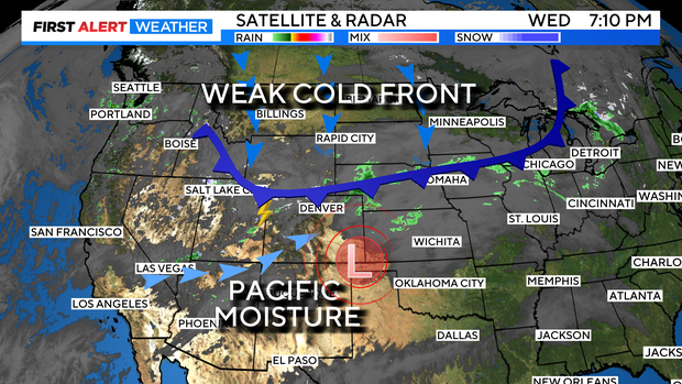
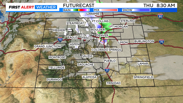
The system is cooler but, not terribly cold. As a result, there will be rain showers in the mix as the change takes place. Light rain showers will develop Wednesday night into Thursday morning. By the morning rush the rain will mix with snow and make for a wet and slick drive for a few areas along the Front Range and eastern plains.
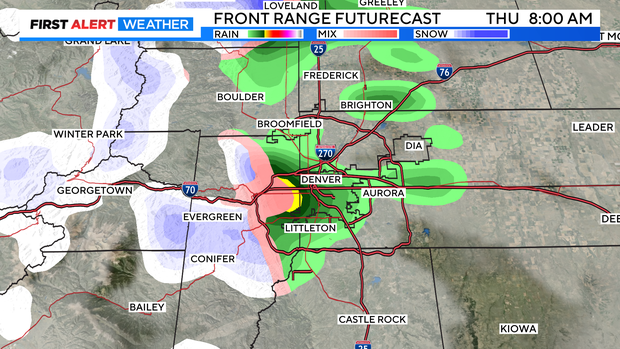
Most Denver metro areas will see little to no accumulation. There may be a half-inch to 1 inch in and near foothill areas. Most of that will be on grassy areas.
Temperatures will be close to freezing for many in the morning with upper 40s to near 50 by afternoon.
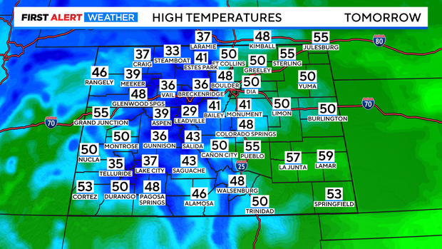
There will be a chance for a few rain showers for the afternoon across the region as well.
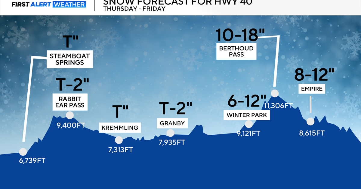
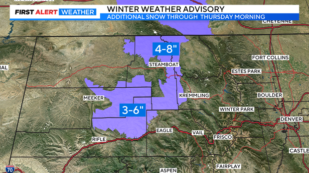
The mountains will see snow Wednesday night into Thursday evening with the heavier amounts in the northwestern mountains from the Park Range around Steamboat Springs to the Flattops. Where an additional 4 to 8 inches of snow is expected by Thursday morning. Most northern and central mountains will see snow showers. But, amounts will be lighter in other areas.
Friday into the weekend will clear out and warm up. With the 60s returning for the Denver metro area by Saturday.