Colorado Weather: A Blast Of Snow And Cold Set To Finish The Week
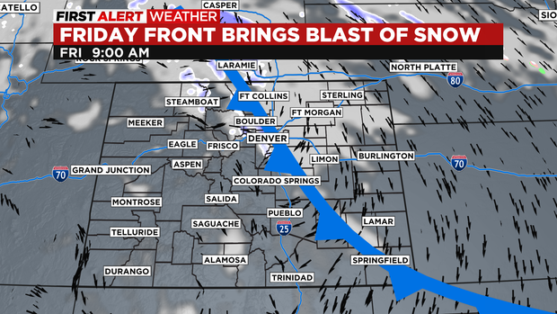
DENVER(CBS)- A fast moving cold front is expected to blow thru the state on Friday. Bringing in a a blast of snow that will have an effect on the Friday afternoon drive.
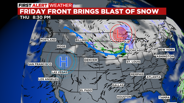
After going thru a week of 50 and 60 degree temperatures the roads around the region are very warm. For that reason a lot of the snow that falls initially on Friday will melt so total snowfall amounts will be lower. The system should start to push into Denver and the Front Range with cooler temps and clouds during the morning rush hour. Snow will not follow until late morning before the lunch hour.
Snow intensity will increase between noon and 6pm. Just in time for the afternoon drive. Most roads in the Denver metro area will be wet during the commute.
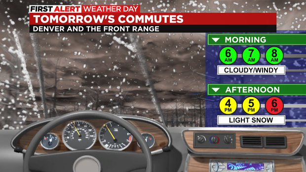
After sunset there may be some freezing and snow sticking in some spots. Especially, in and near any foothill locations west and south of the I-25 corridor.
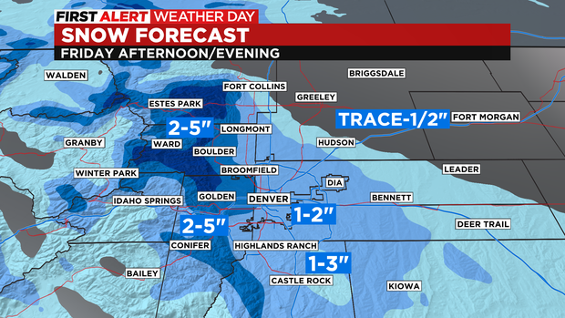
Snow will push south as Friday evening goes on with heavier amounts over the Sangre De Cristo mountains.
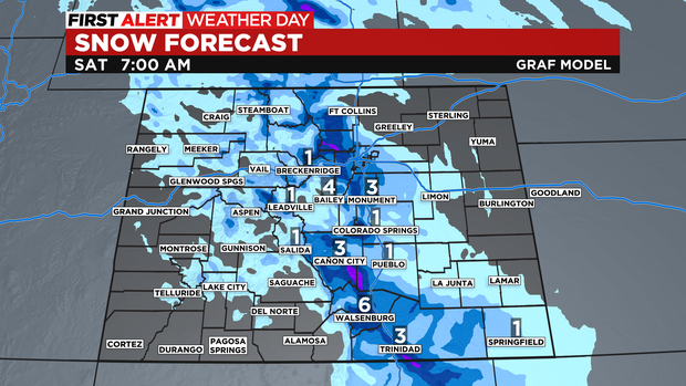
The storm system should clear out by Saturday morning leading to a warming trend thru the middle of next week.