Colorado severe storm threat ramps up, several more days with severe storms possible


Colorado is locked into an active stretch of weather, with severe storms possible across the Front Range and Eastern Plains before heat and fire danger builds this weekend.
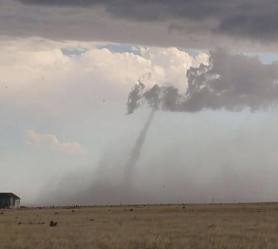
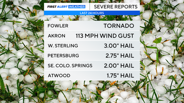
The first round of storms blasted the Eastern Plains with baseball-sized hail and a tornado on Monday afternoon and Monday evening.
Tuesday may be the more impactful severe weather day for the Front Range and I-25 corridor.
A cold front early Tuesday will bring cooler air and more low-level moisture into eastern Colorado. That setup, combined with instability and wind shear, could support supercell thunderstorms on Tuesday afternoon and Tuesday evening.
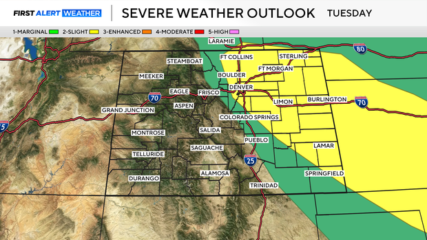
Storms on Tuesday could affect Denver, Boulder, Fort Collins, Castle Rock, and other areas along the I-25 corridor. Large hail, damaging winds, and locally heavy rain will all be possible.
Wednesday brings a similar setup, with another round of strong to severe thunderstorms possible across the lower elevations. Large hail and damaging winds will remain concerns, but flooding may also become a bigger issue by the middle of the week.
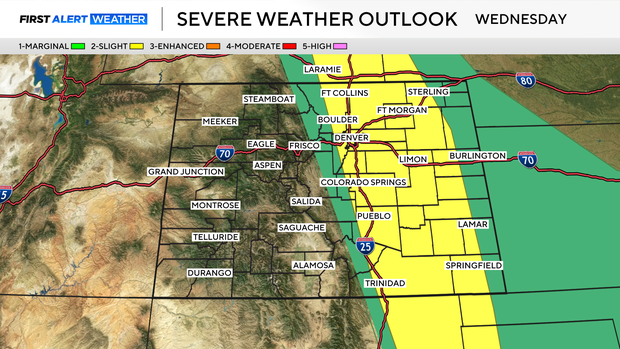
That is because moisture will remain in place for multiple days. If storms repeatedly move over the same areas, localized flash flooding could develop, especially across the plains.
The severe weather threat may continue into Thursday, but confidence is lower compared to Tuesday and Wednesday.


