Flood watch in effect for parts of Philadelphia region Monday with several rounds of storms expected

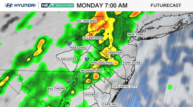
Plan for a wet and stormy Monday in the Philadelphia region, with several rounds of showers and thunderstorms possible throughout the day.
A flood watch is in effect for parts of the Philadelphia region through Monday evening.
Allow extra time for both the morning and evening commutes, and be prepared for sudden downpours that could quickly flood roads and cause travel delays. Keep outdoor plans flexible, especially during the afternoon and evening, and never drive through a flooded roadway.
A few storms could also produce damaging wind gusts, so stay alert, but a large area of severe weather is not likely at this time.
NEXT big weather changes
Tuesday should be the quietest day of the week, with mainly dry conditions expected through much of the daytime.
A warm front will then lift through the region Tuesday night into Wednesday, bringing another round of showers and thunderstorms.
These storms could produce heavy rain and flash flooding, especially in areas that receive significant rainfall on Monday. Slow-moving storms could worsen the flooding threat, while any stronger storms may produce damaging wind gusts.
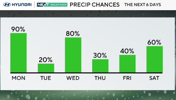
Once the front moves north, warm and humid conditions will settle in for the second half of the week. Thursday through the weekend will feature daily chances for scattered showers and thunderstorms, mainly during the afternoon and evening.
It will not rain all day or everywhere each day, but outdoor plans may need some flexibility as the unsettled summer pattern continues.
Here's your 7-day forecast:
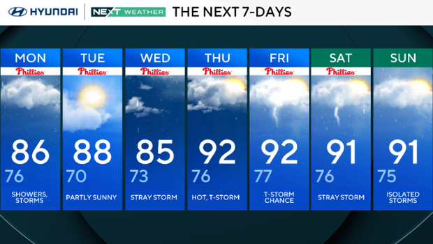
Monday: Showers, storms. High 86, Low 76
Tuesday: Partly sunny. High 88, Low 70
Wednesday: Stray storm. High 85, Low 73
Thursday: Hot, thunderstorm. High 92, Low 76
Friday: Thunderstorm chance. High 91, Low 77
Saturday: Stray storm. High 91, Low 76
Sunday: Isolated storms. High 91, Low 75


